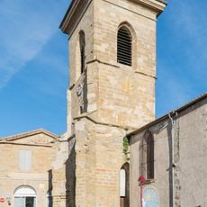
Caux-et-Sauzens, Rural commune in Aude department, France
Caux-et-Sauzens is a commune in southern France covering about 9 square kilometers, positioned between the Montagne Noire and Malepère mountains. It sits roughly 8 kilometers from Carcassonne at an average elevation of 103 meters above sea level.
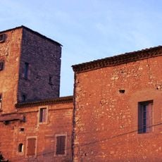
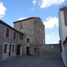
Two former villages, Caux and Sauzens, merged into one administrative unit during the French Revolution in 1791. This consolidation created the modern commune structure that exists today.
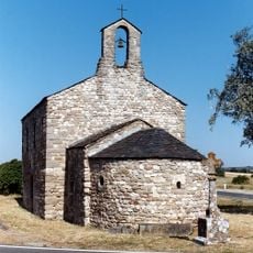
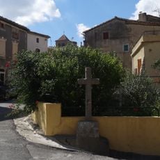
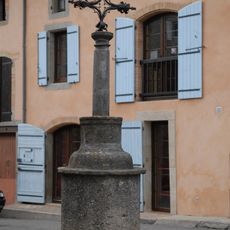
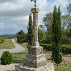
The residents, called Cauxois and Cauxoises, keep local traditions alive in a place where the Occitan name is Caus e Sausens. Daily life here reflects the blend of languages and customs typical of this region near Carcassonne.
This location is rural and best reached by car, as public transportation options are limited in the area. Visitors typically find it helpful to use a map or navigation tool to explore the local roads and surrounding countryside.
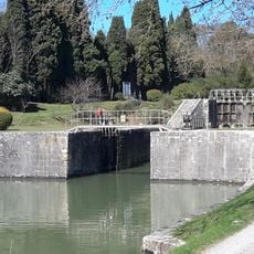
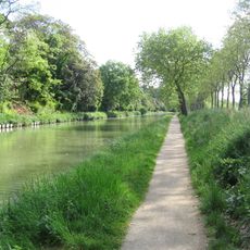
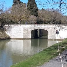
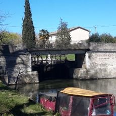
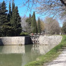
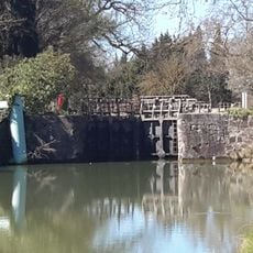
The Canal du Midi passes through the area and marks where two ancient Roman roads once met, one heading toward Toulouse and another toward Ariège. This waterway and the old routes it parallels continue to shape the character of the region today.
Location: canton of Alzonne
Location: Aude
Location: arrondissement of Carcassonne
Elevation above the sea: 103 m
Industry: administration publique générale
Shares border with: Alairac, Arzens, Carcassonne, Lavalette, Pezens, Villesèquelande
Address: 11170 Caux-et-Sauzens, France
Phone: +33468710202
Email: commune-caux-et-sauzens@orange.fr
Website: http://cauxetsauzens.org
GPS coordinates: 43.22556,2.25556
Latest update: December 14, 2025 09:44
Château de Pennautier
5.4 km
Château de l'Abbé
5.1 km
Château d'Arzens
4.7 km
Écluse de Lalande
2.9 km
Épanchoir de Foucaud
5.2 km
Chapelle de la Madeleine
3.7 km
Écluse d'Herminis
3 km
Saint-Germain's Church
4.8 km
Écluse de Béteille
6.2 km
Écluse de la Douce
3.7 kmÉglise Saint-Genès d'Arzens
4.8 km
Écluse de Villeséque
1.3 km
Croix d'Arzens
4.7 km
Croix d'Alairac
4.7 km
Croix de Catuffe
4.1 km
Croix de cimetière de Lavalette
4.6 km
Église Saint-Saturnin de Maquens
6 km
Église Saint-André de Pennautier
5.5 km
Arzens war memorial
4.7 km
Monument aux morts de 1870
7.5 km
Église Saint-Julien-et-Sainte-Basilisse de Ventenac-Cabardès
5.1 km
Église Saint-Martin de Moussoulens
6.4 km
Église de Caux-et-Sauzens
68 m
Water supply basin
7.7 km
Buste d'Omer Sarraut
7.6 km
Monument de saint Dominique
6.2 km
Église de l'Assomption-de-Notre-Dame d'Alzonne
7.1 km
Jardin du Calvaire
7.6 kmVisited this place? Tap the stars to rate it and share your experience / photos with the community! Try now! You can cancel it anytime.
Discover hidden gems everywhere you go!
From secret cafés to breathtaking viewpoints, skip the crowded tourist spots and find places that match your style. Our app makes it easy with voice search, smart filtering, route optimization, and insider tips from travelers worldwide. Download now for the complete mobile experience.
A unique approach to discovering new places❞
— Le Figaro
All the places worth exploring❞
— France Info
A tailor-made excursion in just a few clicks❞
— 20 Minutes