Montbrison

Log in to your account

AroundUs is a community-driven map of interesting places, built by curious explorers like you. It grows with every review, story, and photo you share.
Connect to save your favorite spots, contribute locations, and create personalized routes.
Continue with Google
Continue with Apple
Continue with X
Continue with Facebook
Continue with email
By continuing, you accept our Terms and Conditions and our Privacy Policy
Create an account
Add to collection
Map
Suggest a change
Share

Montbrison, Administrative center in Loire, France

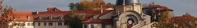
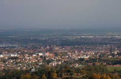
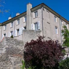
Montbrison is an administrative center in Loire that sits on both sides of the Vizezy River at the base of the Forez Mountains. The town spreads across an elevation of 399 meters and serves as a hub for the surrounding area.

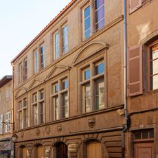
Montbrison served as the capital of the County of Forez until 1531, when it became part of the French royal territory. This transition reshaped the town's political significance and administrative role.

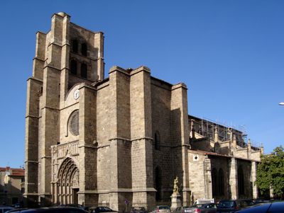
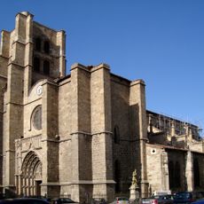
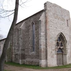
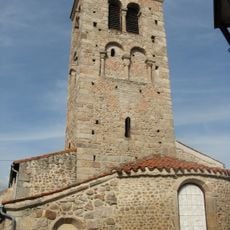
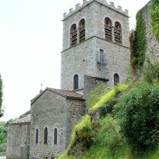
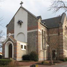
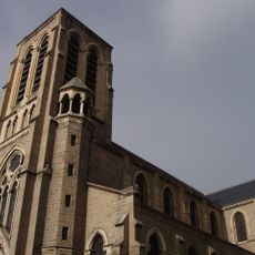
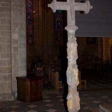
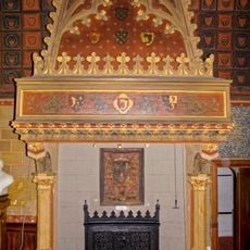
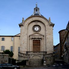
The Collegiate Church of Notre-Dame-d'Espérance reflects the religious heart of Montbrison, drawing locals and visitors into its Gothic interior. Its furnishings and architectural details show how faith has shaped the town's identity for centuries.

The Saturday market runs through multiple streets with local goods, fresh produce, and the regional Fourme cheese specialty available. Arriving early in the morning gives you the best selection and a livelier experience.

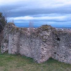
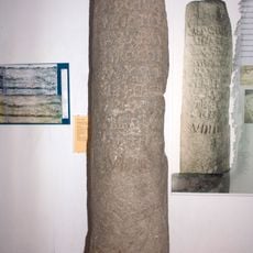
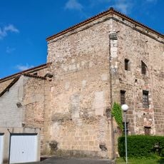
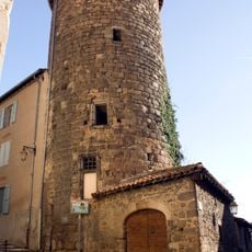
The former Gallo-Roman thermal baths of Moingt merged with Montbrison in 1973 and preserve ancient stone structures beneath the modern town. These archaeological remains reveal how far Roman settlement extended into this region.

Location: Loire

Location: arrondissement of Montbrison

Location: Loire Forez Agglomération

Official opening: 1866

Elevation above the sea: 407 m

Accessibility: Wheelchair accessible

Operator: SNCF Gares & Connexions

Shares border with: Champdieu, Bard, Écotay-l'Olme, Essertines-en-Châtelneuf, Lézigneux, Précieux, Saint-Romain-le-Puy, Saint-Thomas-la-Garde, Savigneux

Address: Place de la Gare, 42600 Montbrison, France

Phone: +33477961818

Email: mairie@ville-montbrison.fr

Website: http://ville-montbrison.fr

GPS coordinates: 45.60750,4.06528

Latest update: December 14, 2025 19:01

Photos
Reviews

Visited this place? Tap the stars to rate it and share your experience / photos with the community! Try now! You can cancel it anytime.

« Montbrison - Administrative center in Loire, France » is provided by Around Us (aroundus.com). Images and texts are derived from Wikimedia project under a Creative Commons license. You are allowed to copy, distribute, and modify copies of this page, under the conditions set by the license, as long as this note is clearly visible.

Discover hidden gems everywhere you go!

From secret cafés to breathtaking viewpoints, skip the crowded tourist spots and find places that match your style. Our app makes it easy with voice search, smart filtering, route optimization, and insider tips from travelers worldwide. Download now for the complete mobile experience.

Around Us App Screenshot

A unique approach to discovering new places

Le Figaro

All the places worth exploring

France Info

A tailor-made excursion in just a few clicks

20 Minutes