Enable Location

We need your location to show you interesting places around you

Discover nearby places

Find interesting locations and hidden gems around you

Precise directions

Get accurate directions and distances to places

Your location is never shared with other users. It's only used when you tap the location button.

Bourg-de-Péage

Log in to your account

Start exploring — it's free

Trusted by 64,287 travelers worldwide

Continue with Google
Continue with Apple
or

We will send you a code to connect

By continuing, you accept our Terms and Conditions and our Privacy Policy

Check your inbox

We've sent a pincode in your inbox. Please enter the code below.

Discussion Reviews 1 Photos
19.5k Popularity

Bourg-de-Péage, French commune in Drôme

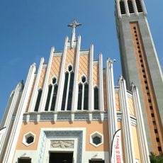
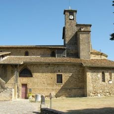
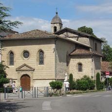
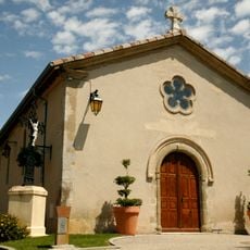
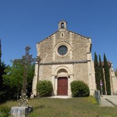
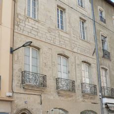
Bourg-de-Péage is a small commune in the Drôme department located on a river bend near the Isère river, surrounded by mountains. The town developed around a stone bridge built in the 11th century that originally included a chapel, tower, and hospital serving travelers and traders.

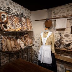
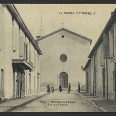
The town began in the early 11th century as a toll station at an important trade bridge where taxes were collected on goods crossing the river. In the 19th century, felt hat-making flourished as a local industry, but declined when imported Australian rabbit hair made local production uncompetitive.

Bourg-de-Péage was historically known for hat-making, especially felt hats made from rabbit hair starting around 1810, and this craft heritage remains part of the town's identity. Today, visitors can taste local tradition at the Pascalis bakery, which has operated since the 1800s and serves a special sweet bread called pogne that locals still enjoy.

The town is easily accessible by highways, train stations, and bus services connecting to larger cities like Valence and Lyon. The Bois des Naix park with about 5 kilometers of walking paths and a fitness course offers visitors options for walking, exercise, and outdoor relaxation.

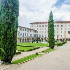
The Bois des Naix was developed from marshy land along a small stream between 1803 and 1824 by Count Dedelay d'Agier, who created the park to provide winter employment. Since 2009, the park has featured an orienteering course where visitors can navigate using maps and compasses.

The community of curious travelers

AroundUs brings together thousands of curated places, local tips, and hidden gems, enriched daily by 60,000 contributors worldwide.

Start exploring
Location
Elevation above the sea
179 m
Shares border with
Romans-sur-Isère, Alixan, Châteauneuf-sur-Isère, Chatuzange-le-Goubet
Phone
GPS coordinates
45.03778,5.05000
Latest update
February 16, 2026 22:40
Reviews
Share your experience

No review yet

Discussions
Start a discussion...

No discussion yet

« Bourg-de-Péage - French commune in Drôme » is provided by Around Us (aroundus.com). Images and texts are derived from Wikimedia project under a Creative Commons license. You are allowed to copy, distribute, and modify copies of this page, under the conditions set by the license, as long as this note is clearly visible.

Discover hidden gems everywhere you go!

From secret cafés to breathtaking viewpoints, skip the crowded tourist spots and find places that match your style. Our app makes it easy with voice search, smart filtering, route optimization, and insider tips from travelers worldwide. Download now for the complete mobile experience.

Around Us App Screenshot

A unique approach to discovering new places

Le Figaro

All the places worth exploring

France Info

A tailor-made excursion in just a few clicks

20 Minutes

Around Us
Travel Guide & Maps
Download

Send to your phone

QR Code
1

Open the camera app on your mobile.

2

Point at the QR code with your camera. A notification will appear.

3

Tap the notification to open the link.