Flers

Log in to your account

AroundUs is a community-driven map of interesting places, built by curious explorers like you. It grows with every review, story, and photo you share.
Connect to save your favorite spots, contribute locations, and create personalized routes.
Continue with Google
Continue with Apple
Continue with X
Continue with Facebook
Continue with email
By continuing, you accept our Terms and Conditions and our Privacy Policy
Create an account
Add to collection
Map
Suggest a change
Share

Flers, Administrative commune in Normandy, France

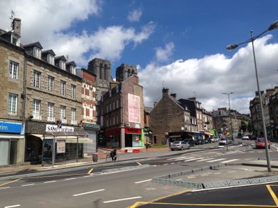
Flers is a town in Normandy located in the Orne department, situated at about 189 meters (620 feet) elevation. The community spans roughly 21 square kilometers and mixes residential neighborhoods with a historical center around its castle.

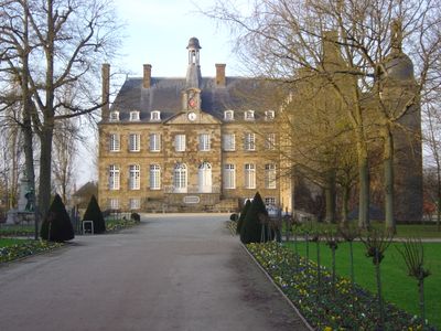
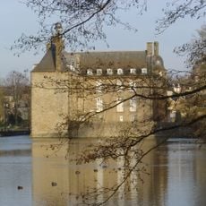
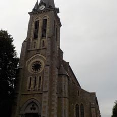
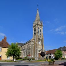
The settlement began in the 12th century when the de Flers family built a wooden fortress that was later rebuilt in stone and surrounded by water. This castle remained the town's defining landmark through the medieval and early modern periods.

The castle in the center now houses a museum displaying artworks and exploring how manufacturing shaped the town's identity and daily life. Visitors can see how local industries influenced the community and its architecture.

A train station offers regular connections to Paris and Granville, making travel convenient for visitors arriving by rail. Local bus services provide easy access around town and to nearby areas.

Allied bombing in June 1944 destroyed about 80 percent of the town, yet it rebuilt itself with a modern layout while preserving key historic buildings. Today, this mix of old and new remains visible throughout the community.

Location: Orne

Location: canton of Flers-Nord

Location: canton of Flers-Sud

Location: arrondissement of Argentan

Elevation above the sea: 219 m

Shares border with: Athis-Val de Rouvre, Aubusson, La Chapelle-au-Moine, La Chapelle-Biche, La Lande-Patry, Messei, Saint-Georges-des-Groseillers, Saint-Paul, La Selle-la-Forge

Address: 61100 Flers, France

Phone: +33233646600

Email: accueil@flers-agglo.fr

Website: https://flers-agglo.fr

GPS coordinates: 48.74833,-0.56944

Latest update: December 17, 2025 08:00

Photos
Reviews

Visited this place? Tap the stars to rate it and share your experience / photos with the community! Try now! You can cancel it anytime.

« Flers - Administrative commune in Normandy, France » is provided by Around Us (aroundus.com). Images and texts are derived from Wikimedia project under a Creative Commons license. You are allowed to copy, distribute, and modify copies of this page, under the conditions set by the license, as long as this note is clearly visible.

Discover hidden gems everywhere you go!

From secret cafés to breathtaking viewpoints, skip the crowded tourist spots and find places that match your style. Our app makes it easy with voice search, smart filtering, route optimization, and insider tips from travelers worldwide. Download now for the complete mobile experience.

Around Us App Screenshot

A unique approach to discovering new places

Le Figaro

All the places worth exploring

France Info

A tailor-made excursion in just a few clicks

20 Minutes