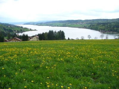
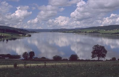
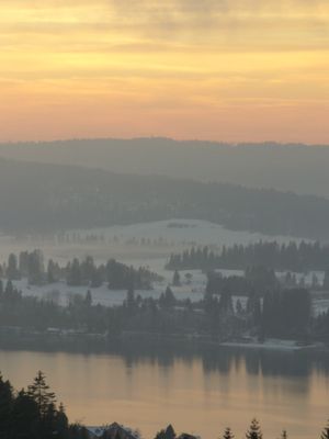
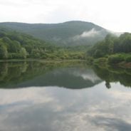
Lac de Saint-Point, Natural glacial lake in Doubs, France
The lake extends over 5.2 square kilometers with a maximum depth of 43 meters and stretches 7.2 kilometers in length through the mountainous landscape.
The lake formed during the last ice age when glacial movements carved out the depression, creating the third largest natural lake in France.
Local fishermen maintain traditional fishing methods on the lake, particularly for catching species such as Arctic char and whitefish throughout the seasons.
Visitors can access multiple supervised beaches around the lake perimeter, with facilities for water sports and boat rentals available from spring through autumn.
The lake water requires 200 days to completely renew itself through the natural flow of the Doubs River system.
Location: Doubs
Elevation above the sea: 850 m
Address: Lac de Saint-Point, 25160, France 25160 Saint-Point-Lac
GPS coordinates: 46.81528,6.31389
Latest update: August 21, 2025 08:27
The Burgundy-Franche-Comté region contains several major lakes of various origins. Lake Saint-Point stretches 6 kilometers in length and ranks as France's second largest natural lake. Lake Vouglans covers 1500 hectares, forming a reservoir along the Ain gorge. The Jura area features ancient natural lakes such as Lake Chalain, formed thousands of years ago. The Belvédère des 4 Lacs provides a viewpoint overlooking the Jura lakes. In the Morvan, historic reservoirs like Lac des Settons enable water activities. The reservoirs of the Canal de Bourgogne reflect the region's waterway heritage. Many of these bodies of water offer swimming facilities and equipment for water sports. The lakes are distributed across different natural landscapes of the region, from the Morvan to the Jura mountains.
Fort Lucotte de Saint-Antoine
3.3 km
Coni'Fer
4.5 km
Abbaye de Mont-Sainte-Marie
4.3 km
Réserve naturelle nationale du lac de Remoray
6.2 km
Gorges du Fourpéret
6.1 km
Maison La Clouterie
4 km
Maison de Monte au Lever
1.3 km
Église Saint-Point de Saint-Point-Lac
932 m
Église Saint-Théodule de Labergement-Sainte-Marie
5.1 km
Église des Hôpitaux-Neufs
6.2 km
Église Saint-Claude de Malbuisson
1.6 km
Usine communale de Métabief
5.2 km
Croix de La Planée
3.8 km
Église de l'Assomption de La Planée
3.7 km
Eglise Saint-Antoine de Saint-Antoine
4.7 km
Grand'Cote (De)
5.3 km
Église Saint-Nicolas d'Oye-et-Pallet
4.6 km
Église Sainte-Madeleine de Montperreux
2.3 km
Église de la Présentation-de-Notre-Dame de Malpas
2.7 km
Église de la Nativité-de-Saint-Jean-Baptiste des Grangettes
1.4 km
Église de la Nativité-de-Notre-Dame de Vaux-et-Chantegrue
4.9 km
Église de la Présentation-de-Notre-Dame de Métabief
5.5 km
Chapelle Notre-Dame-des-Côtes
5.2 km
Chapelle Saint-Claude de Chapelle-Mijoux
4.9 km
Chapelle de la vue du lac
2.6 km
Fontaine de Jeanne-d'Arc de Labergement-Sainte-Marie
5.2 km
Chapelle Sainte-Philomène des Hôpitaux-Vieux
5.1 km
Labergement-Sainte-Marie - Chapelle Saint-Théodule
4.7 kmReviews
Visited this place? Tap the stars to rate it and share your experience / photos with the community! Try now! You can cancel it anytime.
Discover hidden gems everywhere you go!
From secret cafés to breathtaking viewpoints, skip the crowded tourist spots and find places that match your style. Our app makes it easy with voice search, smart filtering, route optimization, and insider tips from travelers worldwide. Download now for the complete mobile experience.
A unique approach to discovering new places❞
— Le Figaro
All the places worth exploring❞
— France Info
A tailor-made excursion in just a few clicks❞
— 20 Minutes