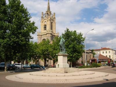
Feurs, Administrative commune in Loire, France
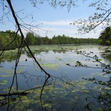
Feurs is a commune in Loire department, situated in the Auvergne-Rhône-Alpes region. It sits at 366 meters elevation on the Forez plain, nestled between the Monts du Lyonnais and Forez mountain ranges, with a layout typical of older settlements in this agricultural valley.
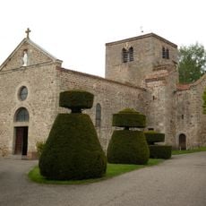
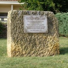
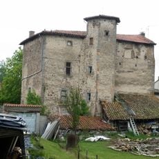
The settlement was known as Forum Segusiavorum during Roman times and served as an important local center. Excavations have uncovered theater remains, sewers, and pottery that reveal the scope of ancient occupation here.
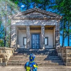
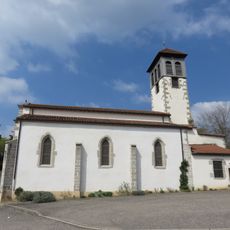
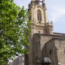
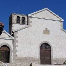
The Chapel of the Martyrs stands as a reminder of the French Revolution's violent period, when 80 people were executed here under the Revolutionary Court. This somber place shapes how locals understand their town's complicated past.
The town supports a working economy with numerous businesses in metalwork, construction, and services that shape its working-class character. Visitors can explore both the town center and easy access to the surrounding mountain terrain and agricultural plains.
Between 1793 and 1795, the town briefly served as the capital of Loire department during France's revolutionary reorganization. This short episode shows how the region held significance during a time of major political upheaval.
Location: Loire
Location: Communauté de communes de Feurs en Forez
Location: arrondissement of Montbrison
Elevation above the sea: 339 m
Shares border with: Valeille, Chambéon, Civens, Cleppé, Poncins, Saint-Laurent-la-Conche, Salt-en-Donzy, Salvizinet
Phone: +33477274000
Email: mairiedefeurs@feurs.fr
Website: http://feurs.org
GPS coordinates: 45.74083,4.22583
Latest update: December 20, 2025 14:57
Musée d'archéologie de Feurs
622 m
Chapelle des martyrs de Feurs
504 m
Écozone du Forez
3.7 km
Église Saint-Laurent de Poncins
5.1 km
Église Notre-Dame de Feurs
434 m
Église Saint-Barthélémy de Salvizinet
4.2 km
Église de la Nativité-de-Notre-Dame de Salt-en-Donzy
4.9 km
Borne frontière des justices de Cleppé et de Poncins
4 kmChâteau de Châtel
3.2 kmFortifications de Feurs
672 m
Forum gallo-romain de Feurs
672 m
Château de Civens
3.5 kmChâteau de Donzy
4.6 kmChâteau de Sainte Anne
4.5 kmChâteau de Bigny
1.9 kmChâteau de Beauregard
3.7 km
Prieuré de Salt-en-Donzy
4.9 kmBuste de Joseph Ory
270 mSite médiéval de Donzy
4.5 kmAgora
335 mMâts des Crues
5.2 kmWork of art, statue
439 mWayside cross
4.2 kmWayside cross
4.8 kmRuines du Donzy
4.5 kmWayside cross
993 mRuines de Donzy
4.6 kmMemorial, commemorative plaque
356 mVisited this place? Tap the stars to rate it and share your experience / photos with the community! Try now! You can cancel it anytime.
Discover hidden gems everywhere you go!
From secret cafés to breathtaking viewpoints, skip the crowded tourist spots and find places that match your style. Our app makes it easy with voice search, smart filtering, route optimization, and insider tips from travelers worldwide. Download now for the complete mobile experience.
A unique approach to discovering new places❞
— Le Figaro
All the places worth exploring❞
— France Info
A tailor-made excursion in just a few clicks❞
— 20 Minutes