Enable Location

We need your location to show you interesting places around you

Discover nearby places

Find interesting locations and hidden gems around you

Precise directions

Get accurate directions and distances to places

Your location is never shared with other users. It's only used when you tap the location button.

Lavaur

Log in to your account

Start exploring — it's free

Trusted by 63,438 travelers worldwide

Continue with Google
Continue with Apple
or

We will send you a code to connect

By continuing, you accept our Terms and Conditions and our Privacy Policy

Check your inbox

We've sent a pincode in your inbox. Please enter the code below.

Discussion Reviews 1 Photos
31.5k Popularity

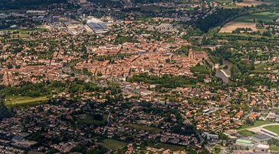
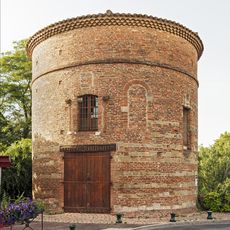
Lavaur, Administrative commune in Tarn, France

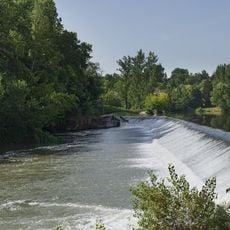
Lavaur is an administrative commune in the Tarn department of southern France, situated along the Agout River in the Occitanie region. The town occupies a location in gentle hillside terrain with buildings arranged around a historic core that has evolved into a modern residential center.

The town reached a turning point in 1211 when crusading forces under Simon de Montfort captured it and altered regional control. This conquest brought major changes to local governance and settlement patterns.

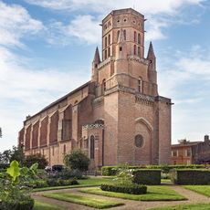
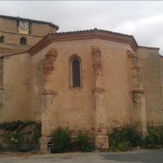
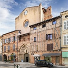
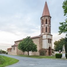
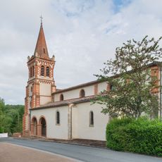
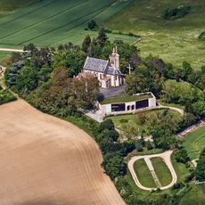
The Cathedral of Saint-Alain stands at the town's center with Gothic architecture that evolved over centuries, and locals use the surrounding square as a gathering place. The houses around the church still follow the layout of the medieval town.

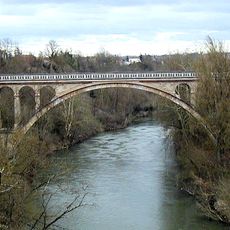
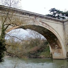
The town is easy to explore on foot since the main buildings and downtown area are close together. The Agout River provides a good landmark and there are walking paths along the banks for getting around.

The name comes from the Gaulish word 'vobero' meaning hidden streams or ravines, which reflects how early inhabitants described the local landscape. This origin shows how the terrain with water and elevation was understood by the people who lived there.

The community of curious travelers

AroundUs brings together thousands of curated places, local tips, and hidden gems, enriched daily by 60,000 contributors worldwide.

Start exploring
Location
Location
Elevation above the sea
167 m
Shares border with
Saint-Jean-de-Rives, Verfeil, Ambres, Belcastel, Fiac, Garrigues, Labastide-Saint-Georges, Lacougotte-Cadoul, Lugan, Marzens, Massac-Séran, Saint-Agnan, Teyssode, Viterbe, Viviers-lès-Lavaur
Phone
GPS coordinates
43.69889,1.81889
Latest update
December 20, 2025 01:19
Reviews
Share your experience

No review yet

Discussions
Start a discussion...

No discussion yet

« Lavaur - Administrative commune in Tarn, France » is provided by Around Us (aroundus.com). Images and texts are derived from Wikimedia project under a Creative Commons license. You are allowed to copy, distribute, and modify copies of this page, under the conditions set by the license, as long as this note is clearly visible.

Discover hidden gems everywhere you go!

From secret cafés to breathtaking viewpoints, skip the crowded tourist spots and find places that match your style. Our app makes it easy with voice search, smart filtering, route optimization, and insider tips from travelers worldwide. Download now for the complete mobile experience.

Around Us App Screenshot

A unique approach to discovering new places

Le Figaro

All the places worth exploring

France Info

A tailor-made excursion in just a few clicks

20 Minutes

Around Us
Travel Guide & Maps
Download

Send to your phone

QR Code
1

Open the camera app on your mobile.

2

Point at the QR code with your camera. A notification will appear.

3

Tap the notification to open the link.