Châteaurenard

Log in to your account

AroundUs is a community-driven map of interesting places, built by curious explorers like you. It grows with every review, story, and photo you share.
Connect to save your favorite spots, contribute locations, and create personalized routes.
Continue with Google
Continue with Apple
Continue with X
Continue with Facebook
Continue with email
By continuing, you accept our Terms and Conditions and our Privacy Policy
Create an account
Add to collection
Map
Suggest a change
Share

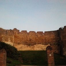
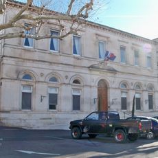
Châteaurenard, Medieval fortress commune in Bouches-du-Rhône, France

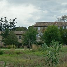
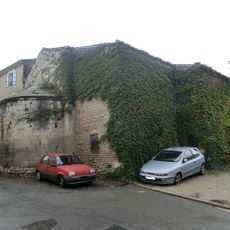
Châteaurenard is a commune in Provence with a medieval castle that sits on a hilltop, retaining two original towers and sections of fortification walls. The village spreads across rolling terrain between Avignon and the Alpilles, with houses clustered at the base and slopes below the castle ruins.

The fortification was built during medieval times and shaped the settlement as a defensive stronghold in the region. Over centuries, the focus shifted from military protection to agriculture, eventually making the area known for its market gardens and farming traditions.

The town has long been tied to vegetable farming, a tradition that continues to shape daily life for residents. The weekly markets showcase this connection, with local growers selling their produce to shoppers and visitors.

The town is best explored on foot, with the castle ruins at the hilltop offering a good vantage point to survey the surrounding streets and markets below. Wear comfortable shoes since there are slopes to climb and the old village paths are uneven.

The Museum of Agricultural Tools and Traditions holds a collection of nineteenth-century machinery and implements rarely seen elsewhere. The exhibits reveal the hand-crafted methods farmers once used across the region.

Location: Bouches-du-Rhône

Location: arrondissement of Arles

Location: canton of Châteaurenard

Location: Communauté d'agglomération Terre de Provence

Elevation above the sea: 33 m

Shares border with: Eyragues, Graveson, Noves, Rognonas, Avignon

Phone: +33490243535

Email: maisondesservices@chateaurenard.com

Website: http://chateaurenard.com

GPS coordinates: 43.88250,4.85500

Latest update: December 20, 2025 12:04

Photos
Reviews

Visited this place? Tap the stars to rate it and share your experience / photos with the community! Try now! You can cancel it anytime.

« Châteaurenard - Medieval fortress commune in Bouches-du-Rhône, France » is provided by Around Us (aroundus.com). Images and texts are derived from Wikimedia project under a Creative Commons license. You are allowed to copy, distribute, and modify copies of this page, under the conditions set by the license, as long as this note is clearly visible.

Discover hidden gems everywhere you go!

From secret cafés to breathtaking viewpoints, skip the crowded tourist spots and find places that match your style. Our app makes it easy with voice search, smart filtering, route optimization, and insider tips from travelers worldwide. Download now for the complete mobile experience.

Around Us App Screenshot

A unique approach to discovering new places

Le Figaro

All the places worth exploring

France Info

A tailor-made excursion in just a few clicks

20 Minutes