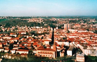
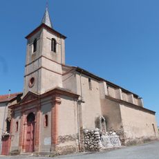
Carmaux, Mining commune in Tarn, France
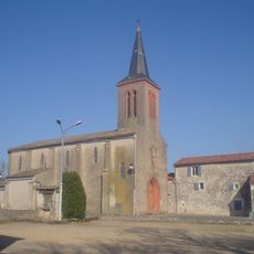
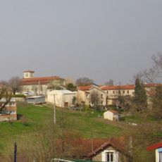
Carmaux is a former mining town in the Tarn department of the Occitanie region, situated about 13 kilometers from Albi. The municipality spans rolling terrain crossed by the Cérou river and retains traces of its industrial past in its buildings and layout.
Coal mining began in 1852 when the Compagnie minière de Carmaux started operations, turning the place into an industrial center. The mines defined the town's identity for over a century until their closure in 2000, which transformed the local economy.
The Friday market brings together residents and visitors through regional products from local farmers and craftspeople. This weekly gathering reflects how the community still values direct exchange and face-to-face connection in daily life.
The railway station provides connections to larger cities like Toulouse, Albi, and Rodez, making it easy to arrive and explore the surrounding region. Visitors are encouraged to use public transportation to move around the town and access nearby areas.
The Cérou river divides the municipality into two separate administrative zones, a division that remains visible in how the territory is organized today. This geographical split reflects in the way local services and governance are arranged across these distinct parts.
Location: canton of Carmaux-Nord
Location: canton of Carmaux-Sud
Location: Tarn
Location: arrondissement of Albi
Elevation above the sea: 277 m
Shares border with: Blaye-les-Mines, Almayrac, Le Garric, Monestiés, Rosières, Saint-Benoît-de-Carmaux, Sainte-Gemme
Address: 81400 Carmaux, France
Phone: +33563802250
Email: accueil@carmaux.fr
Website: http://carmaux.fr
GPS coordinates: 44.04917,2.15806
Latest update: December 7, 2025 09:21
Cap'Découverte
3.5 km
Lac de la Roucarié
4.2 km
Puits de Campgrand
6.6 km
Château de Combefa
5.6 km
Musée de la mine de Cagnac-les-Mines
6.6 km
Château de Saint-Hippolyte
7.1 km
Centrale électrique de la mine de charbon de Carmaux
1.1 km
Château de Trévien
6 km
Clinique Sainte-Barbe de Carmaux
457 m
Église Saint-Hippolyte de Monestiés
7.1 km
Dolmen du Gouty
9.6 km
Carmaux war memorial
436 m
Croix de Salvetat
9 km
Église Saint-Jean-le-Froid (Mailhoc)
6.9 km
Église Saint-Pierre de Monestiés
5.5 km
Église Sainte-Cécile de Carmaux
890 m
Église Saint-Eugène de Rosières
2.2 km
Église Saint-Benoît de Saint-Benoît-de-Carmaux
2.3 km
Église Saint-Pierre de Taïx
5.4 km
Église Saint-Jean-Baptiste de Prunet
10.1 km
Église Saint-Privat de Carmaux
198 m
Église Sainte-Germaine de Dèzes
8.1 km
Église Saint-Saturnin de Saint-Sernin-les-Mailhoc
8.4 km
Église Saint-Salvy de Blaye
3 km
Église Saint-Cirice de Sainte-Gemme
5.6 km
Groupe scolaire de Fontgrande
1.9 km
Chapelle Saint-Jacques de Monestiés
5.5 km
Maison Lagrasse
5.6 kmReviews
Visited this place? Tap the stars to rate it and share your experience / photos with the community! Try now! You can cancel it anytime.
Discover hidden gems everywhere you go!
From secret cafés to breathtaking viewpoints, skip the crowded tourist spots and find places that match your style. Our app makes it easy with voice search, smart filtering, route optimization, and insider tips from travelers worldwide. Download now for the complete mobile experience.
A unique approach to discovering new places❞
— Le Figaro
All the places worth exploring❞
— France Info
A tailor-made excursion in just a few clicks❞
— 20 Minutes