Enable Location

We need your location to show you interesting places around you

Discover nearby places

Find interesting locations and hidden gems around you

Precise directions

Get accurate directions and distances to places

Your location is never shared with other users. It's only used when you tap the location button.

Saint-Chély-d'Apcher

Log in to your account

Start exploring — it's free

Trusted by 62,937 travelers worldwide

Continue with Google
Continue with Apple
or

We will send you a code to connect

By continuing, you accept our Terms and Conditions and our Privacy Policy

Check your inbox

We've sent a pincode in your inbox. Please enter the code below.

Saint-Chély-d'Apcher
Discussion Reviews 1 Photos
24.6k Popularity

Saint-Chély-d'Apcher, Administrative commune in Lozère, France

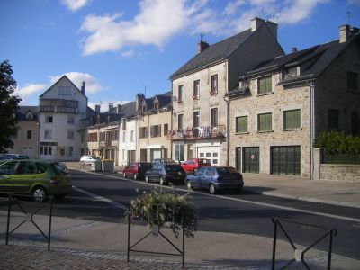
Saint-Chély-d'Apcher is a commune in southern France located in Lozère at an elevation of 935 meters (3,068 feet) with about 4,100 residents. The municipality spans 128 square kilometers (49 square miles) and combines rural and urban features across this central plateau region.

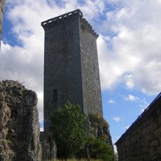
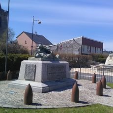
The residents earned the name Barrabans during the Hundred Years War when they successfully defended against English raids in medieval times. This defensive episode became part of the community's identity and local memory.

The town hosts an annual arts festival during the second August weekend that draws performers and artists from across the region. Visitors can experience live music, exhibitions, and performances that shape the local cultural calendar.

The town is easily accessible via the A75 motorway and connects to major cities through regular train services from its central station. Visitors can rely on established transportation links to explore the area or travel onward.

A major steel foundry operated by ArcelorMittal operates here, producing specialized steel products for European markets. This industrial presence forms a significant part of the town's economic base and local character.

The community of curious travelers

AroundUs brings together thousands of curated places, local tips, and hidden gems, enriched daily by 60,000 contributors worldwide.

Start exploring
Location
Location
Arrondissement of Mende
Elevation above the sea
1,024 m
Shares border with
Blavignac, Saint-Pierre-le-Vieux, Prunières, Rimeize, Les Bessons, La Fage-Saint-Julien, Les Monts-Verts, Albaret-Sainte-Marie
Address
48200 Saint-Chély-d'Apcher, France
Phone
GPS coordinates
44.80306,3.27583
Latest update
December 20, 2025 12:18
Reviews
Share your experience

No review yet

Discussions
Start a discussion...

No discussion yet

« Saint-Chély-d'Apcher - Administrative commune in Lozère, France » is provided by Around Us (aroundus.com). Images and texts are derived from Wikimedia project under a Creative Commons license. You are allowed to copy, distribute, and modify copies of this page, under the conditions set by the license, as long as this note is clearly visible.

Discover hidden gems everywhere you go!

From secret cafés to breathtaking viewpoints, skip the crowded tourist spots and find places that match your style. Our app makes it easy with voice search, smart filtering, route optimization, and insider tips from travelers worldwide. Download now for the complete mobile experience.

Around Us App Screenshot

A unique approach to discovering new places

Le Figaro

All the places worth exploring

France Info

A tailor-made excursion in just a few clicks

20 Minutes

Around Us
Travel Guide & Maps
Download

Send to your phone

QR Code
1

Open the camera app on your mobile.

2

Point at the QR code with your camera. A notification will appear.

3

Tap the notification to open the link.