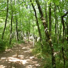
Bois de Païolive, Natural forest in Ardèche, France
Bois de Païolive is a natural forest on a limestone plateau featuring white oak trees growing between eroded rock formations and stone passages. The vegetation creates a maze-like landscape where trees and rocks form natural corridors throughout the woodland.
The forest developed over millions of years as geological forces eroded the limestone plateau into its current maze-like structure. Natural stone corridors formed gradually through water and wind action, shaping the landscape that visitors see today.
The forest serves as a gathering place for nature enthusiasts who come to observe local wildlife and plants in their natural setting. Visitors experience a connection to the land through walking among the distinctive rock formations and vegetation.
The forest offers marked walking trails with parking near the entrance for easy access to the pathways. Wear sturdy shoes since the terrain with rocky sections can be uneven and slippery, especially after rain.
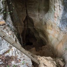
The forest is home to around twenty different bat species that live in its caves and rocky crevices throughout the woodland. Visitors interested in nocturnal wildlife can search for these creatures during evening walks through the stone passages.
The community of curious travelers
AroundUs brings together thousands of curated places, local tips, and hidden gems, enriched daily by 60,000 contributors worldwide.