Enable Location

We need your location to show you interesting places around you

Discover nearby places

Find interesting locations and hidden gems around you

Precise directions

Get accurate directions and distances to places

Your location is never shared with other users. It's only used when you tap the location button.

Champ du Feu

Log in to your account

Start exploring — it's free

Trusted by 62,532 travelers worldwide

Continue with Google
Continue with Apple
or

We will send you a code to connect

By continuing, you accept our Terms and Conditions and our Privacy Policy

Check your inbox

We've sent a pincode in your inbox. Please enter the code below.

Champ du Feu

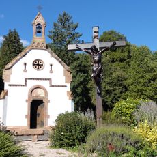
Champ du Feu, Mountain peak in Bas-Rhin, France.

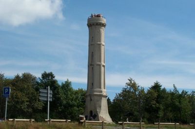
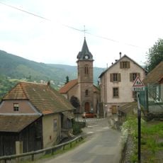
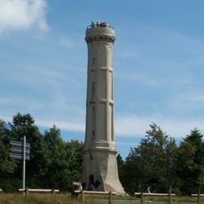
Champ du Feu is the highest peak in Bas-Rhin at 1099 meters, characterized by mountain pastures and granite rock formations across its slopes. The summit hosts an observation tower built in the late 1800s, which remains a focal point for visitors reaching the top.

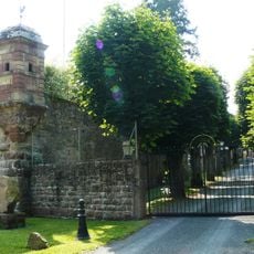
The mountain became accessible to visitors in the late 1800s when hiking clubs and local communities began developing the summit area. The observation tower erected by Club Vosgien in 1898 marked a turning point in bringing organized access to this peak.

The mountain's name carries multiple interpretations rooted in the region's past, reflecting both Germanic influences and local observations of nature. Walking across the summit, visitors encounter these layers of cultural meaning embedded in how locals and travelers speak of the place.

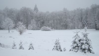
In winter, the mountain operates ski slopes of different difficulty levels to suit various skill ranges. Visiting in December through March offers the best snow conditions, though weather can change quickly at this altitude.

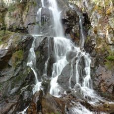
The summit hosts raised peat bogs and mountain grasslands that have adapted to the high elevation, creating habitats rarely seen in the region. These natural environments coexist with ski infrastructure, making it an unexpected combination for this area.

The community of curious travelers

AroundUs brings together thousands of curated places, local tips, and hidden gems, enriched daily by 60,000 contributors worldwide.

Start exploring
Location
Location
Elevation above the sea
1,098 m
GPS coordinates
48.39438,7.26905
Latest update
December 8, 2025 13:43
« Champ du Feu - Mountain peak in Bas-Rhin, France » is provided by Around Us (aroundus.com). Images and texts are derived from Wikimedia project under a Creative Commons license. You are allowed to copy, distribute, and modify copies of this page, under the conditions set by the license, as long as this note is clearly visible.

Discover hidden gems everywhere you go!

From secret cafés to breathtaking viewpoints, skip the crowded tourist spots and find places that match your style. Our app makes it easy with voice search, smart filtering, route optimization, and insider tips from travelers worldwide. Download now for the complete mobile experience.

Around Us App Screenshot

A unique approach to discovering new places

Le Figaro

All the places worth exploring

France Info

A tailor-made excursion in just a few clicks

20 Minutes

Around Us
Travel Guide & Maps
Download

Send to your phone

QR Code
1

Open the camera app on your mobile.

2

Point at the QR code with your camera. A notification will appear.

3

Tap the notification to open the link.