Enable Location

We need your location to show you interesting places around you

Discover nearby places

Find interesting locations and hidden gems around you

Precise directions

Get accurate directions and distances to places

Your location is never shared with other users. It's only used when you tap the location button.

Ménil-Gondouin

Log in to your account

Start exploring — it's free

Trusted by 61,578 travelers worldwide

Continue with Google
Continue with Apple
or

We will send you a code to connect

By continuing, you accept our Terms and Conditions and our Privacy Policy

Check your inbox

We've sent a pincode in your inbox. Please enter the code below.

Ménil-Gondouin, Rural commune in Orne department, Normandy region, France.

Description

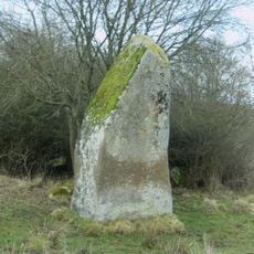
Ménil-Gondouin covers 19.17 square kilometers of rolling countryside in the Suisse Normande area, with elevations ranging from 157 to 254 meters above sea level and comprising several hamlets including La Coconière and La Haute Bruyère.

History

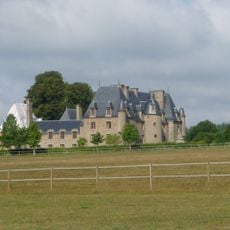
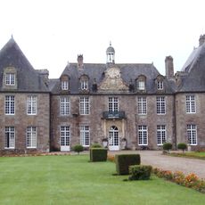
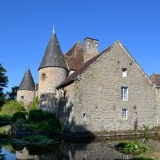
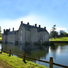
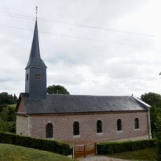
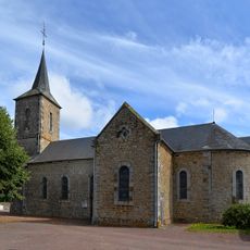
The commune preserves remnants of a 16th-century château once owned by Antoine de Turgot, classified as a Monument historique since 1983, alongside the Logis Saint-Honorine, an 18th-century château with 15th-century outbuildings listed since 1975.

Culture

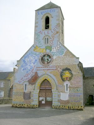
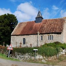
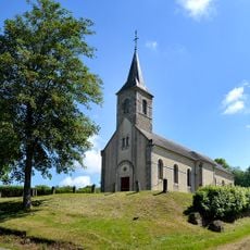
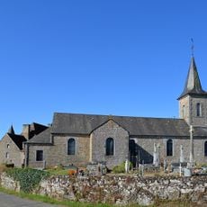
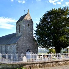
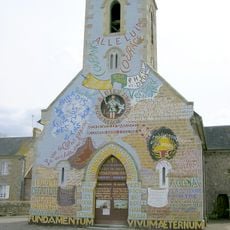
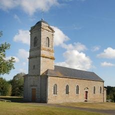
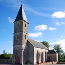
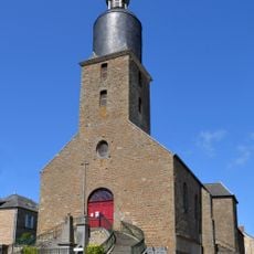
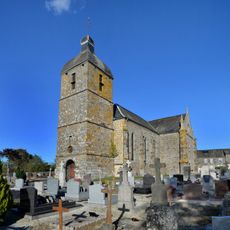
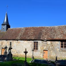
The Saint-Vigor church houses a 14th or 15th-century Crowned Virgin statue head classified as Monument historique since 1984, while the entire interior was decorated with religious inscriptions and statues by parish priest Victor Paysant between 1873 and 1921.

Practical

The town hall at 134 route Abbé-Paysant opens Mondays from 15:00 to 16:30 and Thursdays from 10:30 to 12:00, providing administrative services with accessible facilities including designated parking spaces and barrier-free entrances for disabled visitors.

Did you know?

Known as the 'living and speaking church', Saint-Vigor features comprehensive religious decorations created entirely by one priest who transformed the interior into what resembles a Christian museum with painted and carved biblical quotations covering walls and floors.

Location
Industry
administration publique générale
Shares border with
Sainte-Croix-sur-Orne, Chênedouit, La Fresnaye-au-Sauvage, Putanges-le-Lac, Saint-André-de-Briouze
Address
61210 Ménil-Gondouin, France
Phone
GPS coordinates
48.75444,-0.29361
Latest update
July 21, 2025 10:00

AroundUs brings together thousands of curated places, local tips, and hidden gems, enriched daily by 60,000 contributors worldwide. Discover all places nearby (canton of Putanges-Pont-Écrepin).

« Ménil-Gondouin - Rural commune in Orne department, Normandy region, France » is provided by Around Us (aroundus.com). Images and texts are derived from Wikimedia project under a Creative Commons license. You are allowed to copy, distribute, and modify copies of this page, under the conditions set by the license, as long as this note is clearly visible.

Discover hidden gems everywhere you go!

From secret cafés to breathtaking viewpoints, skip the crowded tourist spots and find places that match your style. Our app makes it easy with voice search, smart filtering, route optimization, and insider tips from travelers worldwide. Download now for the complete mobile experience.

Around Us App Screenshot

A unique approach to discovering new places

Le Figaro

All the places worth exploring

France Info

A tailor-made excursion in just a few clicks

20 Minutes

Around Us
Travel Guide & Maps
Download

Send to your phone

QR Code
1

Open the camera app on your mobile.

2

Point at the QR code with your camera. A notification will appear.

3

Tap the notification to open the link.