Chest opened
+${chestReward.xp} XP
Explorer
NOUVEAU ×${chestReward.collectible.quantity}
tapez pour fermer

See the monuments around you in AR Open chests in the app

Around Us is built for your phone — point your camera at the streets and discover the monuments and places around you in augmented reality. Around Us is built for your phone — chests unlock when you walk, explore and capture nearby places.

•

Enable Location

We need your location to show you interesting places around you

Discover nearby places

Find interesting locations and hidden gems around you

Precise directions

Get accurate directions and distances to places

Your location is never shared with other users. It's only used when you tap the location button.

Lac de Bouzey

Log in to your account

Start exploring — it's free

Trusted by 93,505 travelers worldwide

Continue with Google
Continue with Apple
or

We will send you a code to connect

By continuing, you accept our Terms and Conditions and our Privacy Policy

Check your inbox

We've sent a pincode in your inbox. Please enter the code below.

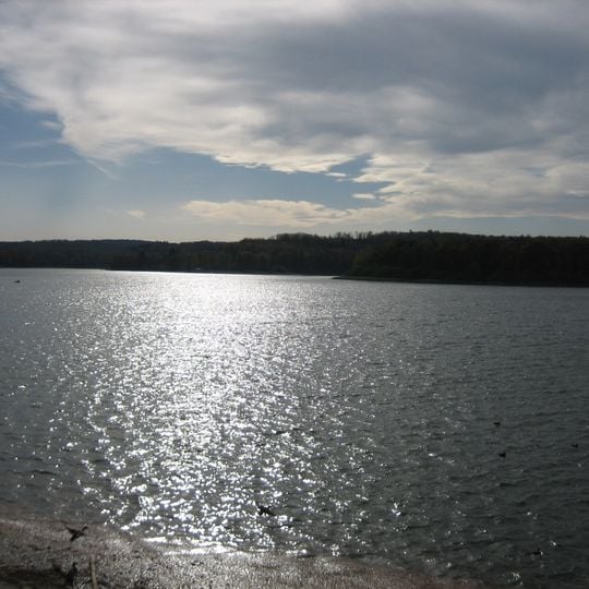
Lac de Bouzey, lake in Vosges, Grand Est, France

Lac de Bouzey is a 127-hectare reservoir at 360 m altitude in the Vosges, held back by a 525 m long masonry gravity dam founded on Triassic sandstone. The lake, fed by a 42 km feeder channel from the Moselle, has a maximum depth of 12.5 m and a volume of 7 million m³. Its level varies with the needs of the Canal des Vosges.

The reservoir was built to feed the Canal de l'Est, dug between 1874 and 1887 after the 1871 annexation of Alsace-Lorraine cut France off from the Rhine. The masonry gravity dam, 525 m long and 20 m high on Triassic sandstone, was commissioned in 1880. Part of its upper wall collapsed on 27 April 1895, killing 86 people in the Avière valley.

The water level varies greatly with the reservoir's filling and canal-supply cycles, so the shoreline shifts; the minimum on record was 163,000 m3 in November 2019. A 15 km cycle path links the shore to the harbour and the town of Épinal. A restaurant, a campsite and a sailing school stand on the banks, and bathing is possible.

The 1895 collapse of the masonry dam, 525 m long and 20 m high, killed 86 people in the Avière valley. Engineers then identified uplift pressure under the foundation, a mechanism later taught in dam engineering. The dam was rebuilt and reinforced with a downstream rockfill between 1930 and 1939.

The community of curious travelers

AroundUs brings together thousands of curated places, local tips, and hidden gems, enriched daily by 93,505 contributors worldwide.
Start exploring
Location
Elevation above the sea
360 m
GPS coordinates
48.16513,6.35688
Latest update
October 31, 2026 11:43
Reviews
Share your experience

No review yet

Discussions
Start a discussion...

No discussion yet

« Lac de Bouzey - lake in Vosges, Grand Est, France » is provided by Around Us (aroundus.com). Images and texts are derived from Wikimedia project under a Creative Commons license. You are allowed to copy, distribute, and modify copies of this page, under the conditions set by the license, as long as this note is clearly visible.

Discover hidden gems everywhere you go!

From secret cafés to breathtaking viewpoints, skip the crowded tourist spots and find places that match your style. Our app makes it easy with voice search, smart filtering, route optimization, and insider tips from travelers worldwide. Download now for the complete mobile experience.

Around Us App Screenshot
❝

A unique approach to discovering new places❞

— Le Figaro

❝

All the places worth exploring❞

— France Info

❝

A tailor-made excursion in just a few clicks❞

— 20 Minutes

Around Us
Travel Guide & Maps
Download

Send to your phone

QR Code
1

Open the camera app on your mobile.

2

Point at the QR code with your camera. A notification will appear.

3

Tap the notification to open the link.
