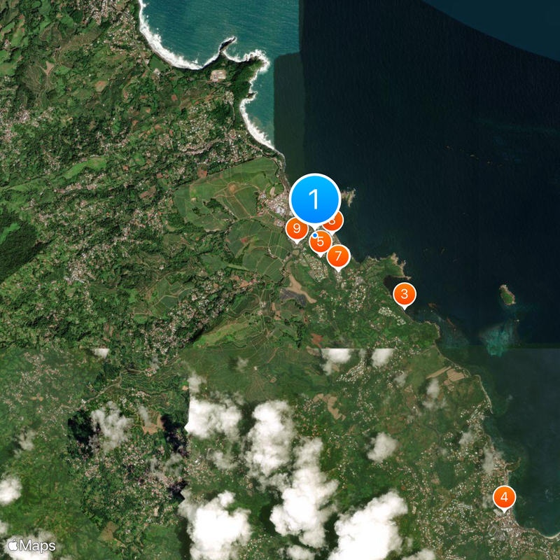
Sainte-Marie, Coastal administrative division in Martinique, France
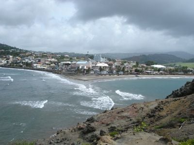
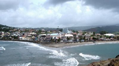
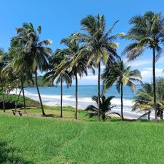
Sainte-Marie is a coastal commune on Martinique's Atlantic shore, divided into several distinct districts that sprawl across residential areas. The territory combines lived-in neighborhoods with natural coastal features and historic structures that shape the area's character.
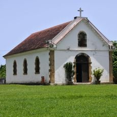
The territory was originally settled by Carib peoples before Europeans built a fort and established sugar production in 1658. This early colonial enterprise shaped the region's economy and society for centuries afterward.
The Fonds Saint-Jacques estate showcases exhibitions about Caribbean heritage and its connection to the sugar industry. Walking through the space, you can see how this former plantation and monastery reflects the region's complex past and cultural roots.
The location is easily accessible by public transportation, with stops positioned near the main centers of activity. For local services and information, visitors can reach the municipal office during weekday hours.
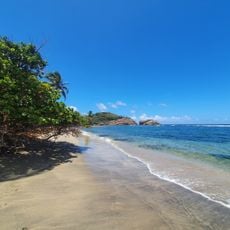
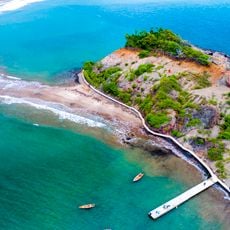
The Tombolo of Sainte-Marie is a natural sand formation that connects the mainland to a small island during low tide. This rare natural feature disappears when the water rises, offering an unusual experience for visitors interested in coastal geography.
Location: canton of Sainte-Marie-1-Nord
Location: Martinique
Location: canton of Sainte-Marie-2-Sud
Location: arrondissement of La Trinité
Shares border with: Gros-Morne, Le Marigot, La Trinité
Phone: +33596693006
Email: secretariat.cabinet.vsm@gmail.com
GPS coordinates: 14.78139,-60.99361
Latest update: December 7, 2025 10:01
Jardin de Balata
16.2 km
Balata Garden
10.4 km
Château Dubuc
11.2 km
Phare de La Caravelle
12.1 km
Habitation Leyritz
14.5 km
Our Lady Church
15.3 km
Habitation Gradis
16.3 km
Our Lady of the Assumption Church, Sainte-Marie
220 m
Observatoire du Morne des Cadets
17.2 km
Réserve naturelle nationale de la presqu'île de la Caravelle
11.7 km
Saint Hyacinth Church
8.9 km
Église de l'Immaculée-Conception de L'Ajoupa-Bouillon
13.9 km
Plage de l'Anse Azerot
1.9 km
Domaine d'Emeraude
12.1 km
Église Sainte Jeanne d’Arc du Vert-Pré
10.2 km
Église de la Sainte-Trinité de La Trinité
5.6 km
Église Saint-Jean-Baptiste de Basse-Pointe
16.3 km
Monument aux morts de Sainte-Marie
344 m
Cascade Didier
17.3 km
Église Notre-Dame-de-la-Visitation de Gros-Morne
8 km
Calvaire de Morne-Rouge
14.9 km
Église Saint-Denis de Fonds-Saint-Denis
15.6 km
Plage de l'Anse l'Étang
9.6 km
Monument aux morts de Saint-Joseph
13.8 km
Chapelle du domaine de Fonds-Saint-Jacques
2.3 km
Volcanoes and Forests of Mount Pelée and the Pitons of Northern Martinique
8.9 km
Tombolo de Sainte-Marie
667 m
Habitation Pécoul
14.3 kmVisited this place? Tap the stars to rate it and share your experience / photos with the community! Try now! You can cancel it anytime.
Discover hidden gems everywhere you go!
From secret cafés to breathtaking viewpoints, skip the crowded tourist spots and find places that match your style. Our app makes it easy with voice search, smart filtering, route optimization, and insider tips from travelers worldwide. Download now for the complete mobile experience.
A unique approach to discovering new places❞
— Le Figaro
All the places worth exploring❞
— France Info
A tailor-made excursion in just a few clicks❞
— 20 Minutes