Forêt de Dourdan, forest in France
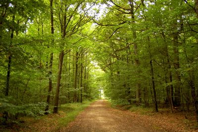
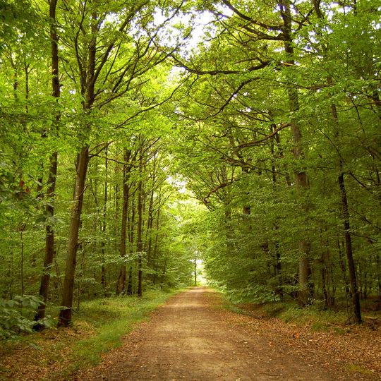
The Forêt de Dourdan is a state-managed forest covering roughly 1.600 hectares across several towns southwest of Paris. The Orge river runs through the land, with sessile oaks forming the main tree population, mixed with beech, hornbeam, chestnut, and pine on sandier slopes.
From the Merovingian period the woods belonged to the royal domain. The forest of l'Ouÿe takes its name from the abbey founded in 1163 by Louis le Pieux; Philip Augustus revoked his father's donation, but Saint Louis returned the land to the nuns, who kept it until the Revolution. Louis XIV granted the rest to his brother Philippe d'Orléans, and it stayed with the Orléans family until 1870, when it passed definitively to the State.
The forest's name comes from the Ouÿe, a Celtic root for water referring to the Orge, and from the abbey founded in 1163. The Chêne des Six Frères, a 500-year-old sessile oak 6.70 m around and 33 m tall, was a pilgrimage site: a basin at its centre was said to hold blessed water.
The forest has numerous walking trails and tracks, including sections of long-distance routes GR 1 and GR 111 that suit cycling too. Local tourism offices provide simple forest maps, and signposts and informational panels mark various spots and forest history.
The Chêne des Six Frères, a sessile oak about 500 years old, has a stump that splits into six trunks from a single acorn, a form rarely seen. Its trunk measures 6.70 m around and the tree rises 33 m. A basin at its centre, almost always holding water said to be blessed, made it a place of pilgrimage and procession.
The community of curious travelers
AroundUs brings together thousands of curated places, local tips, and hidden gems, enriched daily by 93,276 contributors worldwide.