Mont Seigne, Summit in Lévézou, France
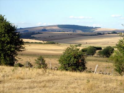
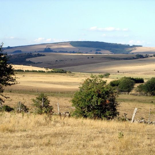
Mont Seigne is a summit in the Lévézou, on the commune of Saint-Laurent-de-Lévézou in Aveyron, reaching 1,121 or 1,128 m, the second-highest point of the Lévézou. Its broad, rounded crest carries a continuous band of dark green trees, while the slopes below are dry pale-gold grass crossed by faint paths, with a few clusters of darker vegetation on the lower slope.
Mont Seigne, at 1,121 or 1,128 m, is the second-highest summit of the Lévézou, in the commune of Saint-Laurent-de-Lévézou, Aveyron. Its Occitan name, Mont Sénher, is recorded alongside the French form. The summit rises above the wooded crest and dry grass slopes visible from the surrounding plateau.
The summit lies on the commune of Saint-Laurent-de-Lévézou, and the name has an Occitan form, Mont Sénher, still used in the region. The dry gold grass on the slopes, crossed by faint paths, is grazed land, so walkers share the hill with livestock.
Mont Seigne lies on the commune of Saint-Laurent-de-Lévézou, reached by road from the village; the summit area is open grassland crossed by faint tracks, with no marked trailhead or facilities. The wooded crest and dry slopes offer little shade, so carry water and wind protection. Snow and mud can make the upper slopes slow going outside summer.
Mont Seigne, at 1,121 or 1,128 m, is the second-highest summit of the Lévézou, after Mont Clapas. It lies in the commune of Saint-Laurent-de-Lévézou, Aveyron, Occitanie, and its Occitan name is Mont Sénher. The wooded crest seen from below hides the summit from the surrounding plateau.
The community of curious travelers
AroundUs brings together thousands of curated places, local tips, and hidden gems, enriched daily by 94,757 contributors worldwide.