Chest opened
+${chestReward.xp} XP
Explorer
NOUVEAU ×${chestReward.collectible.quantity}
tapez pour fermer

See the monuments around you in AR Open chests in the app

Around Us is built for your phone — point your camera at the streets and discover the monuments and places around you in augmented reality. Around Us is built for your phone — chests unlock when you walk, explore and capture nearby places.

•

Enable Location

We need your location to show you interesting places around you

Discover nearby places

Find interesting locations and hidden gems around you

Precise directions

Get accurate directions and distances to places

Your location is never shared with other users. It's only used when you tap the location button.

Montagne de Dun

Log in to your account

Start exploring — it's free

Trusted by 94,757 travelers worldwide

Continue with Google
Continue with Apple
or

We will send you a code to connect

By continuing, you accept our Terms and Conditions and our Privacy Policy

Check your inbox

We've sent a pincode in your inbox. Please enter the code below.

Montagne de Dun

Montagne de Dun, Mountain summit in the Brionnais, Saône-et-Loire, France

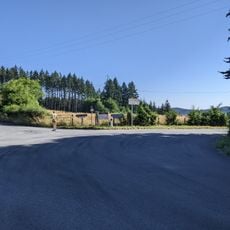
Montagne de Dun is a summit in the Brionnais, on the commune of Saint-Racho in Saône-et-Loire, reaching 736 metres and overlooking the Sornin valley. Its highest point, called Dunet, rises slightly to the east at 732 metres, while the main summit at 721 metres holds two orientation tables. The slopes are steep and difficult to climb.

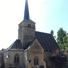
Dun was the seat of the viscounty of Mâcon until the 12th century, held by the Le Blanc family. In 1180 Philippe Auguste besieged the fortress and took it; the walls were razed and only the church was spared, because "the King of France does not destroy the house of the King of Heaven".

The name Dun comes from a Celtic root meaning "citadel, fortress, fortified enclosure", later "hill, mount". The mountain gave its name to villages such as Anglure-sous-Dun, Mussy-sous-Dun and La Chapelle-sous-Dun; Chauffailles was called Saint-André-sous-Dun until 1254, when a large fire led to its new name. In 1580 Dun was still a pilgrimage site, climbed on 29 June for Saints Peter and Paul and on 9 October for Saint Denis.

The summit plateau, at 721 m, holds two orientation tables, one facing La Clayette and one facing Chauffailles, from which more than 25 bell towers can be seen. The true high point, Dunet, lies slightly east at 732 m. The climb is steep, so plan for the gradient and carry water.

The summit's orientation tables, one facing La Clayette and one facing Chauffailles, reveal more than 25 bell towers. The true high point, called Dunet, lies slightly east at 732 metres, while the marked summit is 721 metres. The name Dun comes from a Celtic root meaning citadel or fortified enclosure.

The community of curious travelers

AroundUs brings together thousands of curated places, local tips, and hidden gems, enriched daily by 94,757 contributors worldwide.

Start exploring
Location
Elevation above the sea
708 m
Part of
Beaujolais
GPS coordinates
46.25440,4.35129
Latest update
October 26, 2026 02:02
Around this place
Show the full map
Reviews
Share your experience

No review yet

Discussions
Start a discussion...

No discussion yet

« Montagne de Dun - Mountain summit in the Brionnais, Saône-et-Loire, France » is provided by Around Us (aroundus.com). Images and texts are derived from Wikimedia project under a Creative Commons license. You are allowed to copy, distribute, and modify copies of this page, under the conditions set by the license, as long as this note is clearly visible.

Discover hidden gems everywhere you go!

From secret cafés to breathtaking viewpoints, skip the crowded tourist spots and find places that match your style. Our app makes it easy with voice search, smart filtering, route optimization, and insider tips from travelers worldwide. Download now for the complete mobile experience.
Around Us App Screenshot
❝

A unique approach to discovering new places❞

— Le Figaro

❝

All the places worth exploring❞

— France Info

❝

A tailor-made excursion in just a few clicks❞

— 20 Minutes

Around Us
Travel Guide & Maps
Download

Send to your phone

QR Code
1

Open the camera app on your mobile.

2

Point at the QR code with your camera. A notification will appear.

3

Tap the notification to open the link.