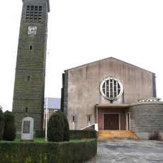
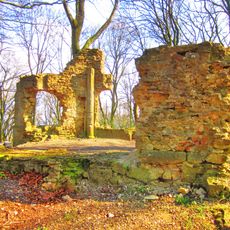
Ouvrage Rochonvillers, Military fortification in Rochonvillers, France
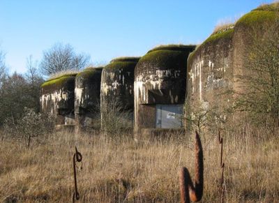
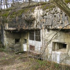
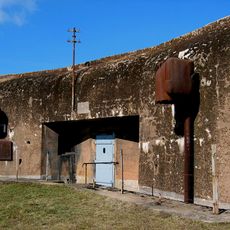
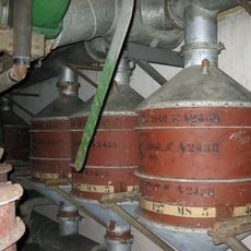
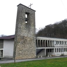
Ouvrage Rochonvillers is an underground military fortification with nine combat blocks and two entrances connected by galleries approximately 30 meters below ground level. The structure contained sleeping quarters, kitchens, ammunition storage, power generators, and ventilation systems designed to operate independently for extended periods.
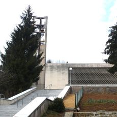
French forces built this Maginot Line fortification between 1929 and 1935 as part of their eastern border defense strategy. During the 1980s, the site was converted into a nuclear-resistant command center capable of sheltering large groups for extended periods.
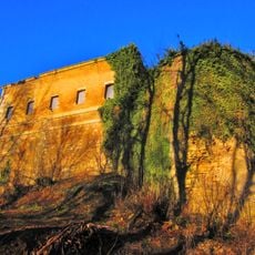
The fortress represents the military defense strategy of France during the 1930s, demonstrating the engineering capabilities of that period.
Access involves climbing stairs and navigating narrow underground passages that require reasonable physical fitness. Interior spaces remain consistently cool and damp, so bringing an extra layer of clothing is advisable.
The site was designed as a self-contained unit capable of supplying all necessities for 782 soldiers stationed within it. This made it function like a complete underground community with kitchens, sleeping areas, and ammunition manufacturing inside.
Inception: 1930
GPS coordinates: 49.40250,6.03972
Latest update: December 11, 2025 11:03
Ouvrage Molvange
3.3 km
Château de Volkrange
5.9 km
Château d'Ottange
4.4 km
Casemate of Grand-Lot
1.7 km
Église Saint-Jean-Baptiste d'Algrange
5.1 km
Abri d'Hettange
4.8 km
Église St-Jean-Baptiste de Volkrange
6.1 km
Église Saint-Michel d'Angevillers
1.8 km
Église Saint-Willibrord d'Ottange
4.5 km
Église Saint-Pierre de Tressange
4.3 km
Église Saint-Jean-Baptiste d'Havange
3.7 km
Église Saint-Denis de Volmerange-les-Mines
5.4 km
Église Saint-Maurice de Kanfen
5.7 km
Chapelle Saint-Willibrord d'Escherange
3.7 km
Église de la Visitation-de-la-Vierge d'Œutrange
4.6 km
Chapelle Notre-Dame-des-Neiges de Beuvange-sous-Saint-Michel
5.3 km
Chapelle Saint-Antoine-de-Padoue d'Algrange
4.1 km
Ancienne église Saint-Michel d'Angevillers
1.8 km
Église Saint-Luc de Rochonvillers
1.5 km
Chapelle Sainte-Jeanne d'Entrange
6 km
Temple d'Algrange
4.6 km
Église Saint-Pierre d'Escherange
2.7 km
Chapelle Saint-Luc de Bassompierre
5.8 km
Chapelle Saint-Hubert d'Entrange
4.9 km
Chapelle Notre-Dame de Bure
3.3 km
Chapelle de Nondkeil
3.2 km
Temple protestant de Fontoy
5.9 km
Chapelle dite du Lépreux ou du Mont-Saint-Michel de Côte Saint-Michel
4.6 kmVisited this place? Tap the stars to rate it and share your experience / photos with the community! Try now! You can cancel it anytime.
Discover hidden gems everywhere you go!
From secret cafés to breathtaking viewpoints, skip the crowded tourist spots and find places that match your style. Our app makes it easy with voice search, smart filtering, route optimization, and insider tips from travelers worldwide. Download now for the complete mobile experience.
A unique approach to discovering new places❞
— Le Figaro
All the places worth exploring❞
— France Info
A tailor-made excursion in just a few clicks❞
— 20 Minutes