Réserve naturelle nationale de l'île du Girard, protected area in France
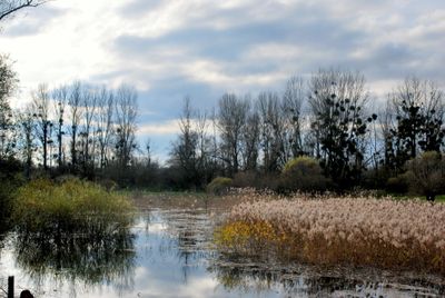
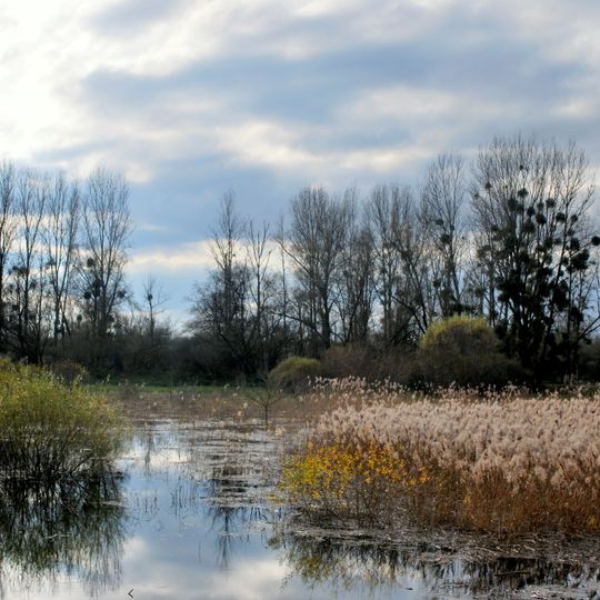
The Île du Girard National Nature Reserve covers 135.37 hectares on the right bank of the Doubs, at its confluence with the Loue and the Clauge. Since hydraulic works between 1962 and 1965 cut a new channel, the reserve has formed a temporary island between the Vieux Doubs to the west and the Nouveau Doubs to the east. Its mosaic of sandbanks, muddy shores, pastures, reed beds and willow-dominated riparian forest lies at 193–195 m altitude.
The reserve was created in 1982 after nearly fifteen years of administrative delays. The project was first proposed by Mr. Bailly of the DDA, then carried forward by Jean-Marie Goudot and Jacques Terraz. Its designation followed recognition of the site's biological richness and the persistence of local scientists. The reserve covers 136 hectares across Gevry, Molay, Parcey and Rahon.
The reserve's name comes from the Île du Girard, the island formed between the old Doubs channel (Vieux Doubs) and the new one dug east of it during the 1962–1965 hydraulic works at the Loue confluence. A waymarked interpretation trail crosses the island from Gevry to its southern tip, where an observatory looks over the water and reed beds.
Access is easy from the commune of Gevry via marked trails that cross the island. An observation platform at the island's tip allows visitors to watch wildlife without disturbing the natural environment.
The reserve lies on a temporary island: after the Doubs-Loue confluence was rechanneled and embanked between 1962 and 1965, the old riverbed (Vieux Doubs) was cut off to the west and a new channel dug to the east. The reserve's boundaries follow the high banks of both channels.
The community of curious travelers
AroundUs brings together thousands of curated places, local tips, and hidden gems, enriched daily by 94,047 contributors worldwide.