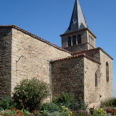
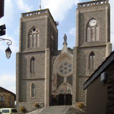
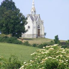
Signal de Saint-André, Mountain summit in Monts du Lyonnais, France
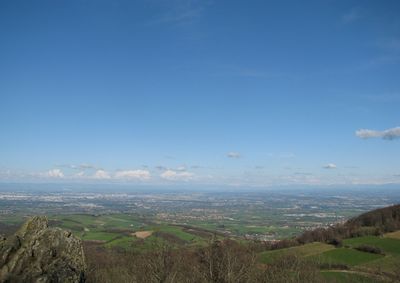
Signal de Saint-André is a mountain summit in the Monts du Lyonnais located at 934 meters in elevation. In clear weather, it offers views reaching toward Lyon, the Alps, and the Pilat massif across the landscape.
In 1744, cartographer César-François Cassini established a geodetic marker at this summit. This was part of his assignment to create the first detailed map of France.
The summit has a small outdoor amphitheater with seating for about 30 people, where local events and educational talks happen regularly throughout the year. This space brings together visitors and residents to share knowledge and enjoy performances in an open-air setting.
From the parking area on road D113, an 800-meter uphill walk reaches the summit following the marked GR7 hiking trail. The path is clearly marked and passes near the village of Saint-André-la-Côte.
The summit houses one of 53 French National Frequency Agency stations. This facility is used for radio spectrum control and goniometric location measurements.
Location: Rhône
Elevation above the sea: 934 m
GPS coordinates: 45.63825,4.59324
Latest update: December 14, 2025 11:01
Chapelle Saint-Vincent de Saint-Laurent-d'Agny
6.4 km
Plateau d'Yzeron
7.4 km
Église de la Conversion-de-Saint-Paul de Riverie
4.4 km
Église Saint-Martin de Thurins
6.2 km
Église Saint-Pierre de Mornant
6.4 km
Chapelle Saint-Jean-Baptiste de Châteauvieux
7.8 km
Église Saint-Laurent de Saint-Laurent-d'Agny
7.3 km
Église Saint-André de Saint-André-la-Côte
1.1 km
Église Saint-Jean-Baptiste de Chaussan
3.6 km
Église Sainte-Catherine de Sainte-Catherine
4.7 km
Église Saint-Romain de Rontalon
3.9 km
Église Notre-Dame-de-Pitié de Rochefort
3.6 km
Église Saint-Saturnin de Saint-Sorlin
4.1 km
Bridge of Virieux
6.7 km
Bridge of Grand Bozançon
7.4 km
Église Saint-Didier de Saint-Didier-sous-Riverie
4.9 km
Bridge of La Billannière
6.8 km
Bridge of Jurieux
7.3 km
Église Saint-Barthélemy d'Yzeron
7.8 km
Église Saint-Jean-Apôtre de Duerne
7.2 km
Bridge of Les Granges
7.8 km
Château Le Clos Bourbon
6.7 km
Château de la Fay
7.9 km
Croix du Chemin des Anvers
7.3 km
Pont-aqueduc du Mornantet
6.2 km
Chapelle Saint-Roch de Rontalon
3.7 km
Chapelle Notre-Dame-de-Lourdes de Crêt Chagneux
8.5 km
Tour de la Dîme
6.4 kmVisited this place? Tap the stars to rate it and share your experience / photos with the community! Try now! You can cancel it anytime.
Discover hidden gems everywhere you go!
From secret cafés to breathtaking viewpoints, skip the crowded tourist spots and find places that match your style. Our app makes it easy with voice search, smart filtering, route optimization, and insider tips from travelers worldwide. Download now for the complete mobile experience.
A unique approach to discovering new places❞
— Le Figaro
All the places worth exploring❞
— France Info
A tailor-made excursion in just a few clicks❞
— 20 Minutes