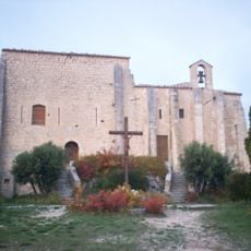
Signal de Saint-Pierre, Mountain summit in Vaucluse Mountains, France.
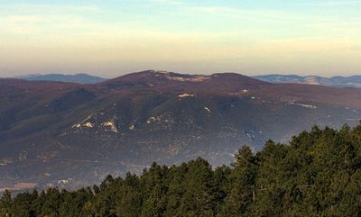
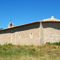
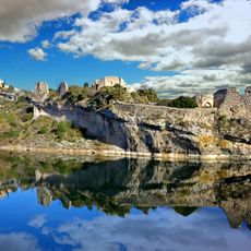
Signal de Saint-Pierre is a summit in the Vaucluse Mountains with an elevation of 1,256 m (4,124 ft), the highest point in the Luberon Regional Nature Park. The mountain consists of limestone formations and offers far-reaching views from the top across the landscape below with its plains and distant ranges.
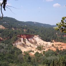
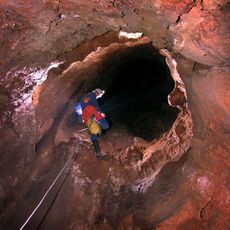
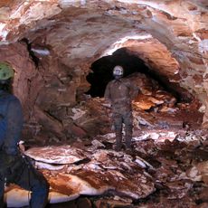
The mountain formed during the Mesozoic era through geological processes that created massive limestone deposits. Over time, water erosion shaped underground caverns and channels, forming the karst landscape system that exists there today.
The slopes have been shaped by lavender growers for centuries, whose traditional farming methods still define the landscape today. Visitors walking upward encounter small lavender fields and old dry stone terraces that speak to this long agricultural tradition.
The ascent follows marked hiking trails accessible from road D40, with parking available near the base of the mountain. Visitors should wear sturdy footwear and bring adequate water and sun protection depending on the season.
Lavender growers in this region produce a significant share of French fine lavender oil, thanks to the elevation and local climate that create particularly aromatic varieties. The area is recognized by perfume makers and distilling specialists worldwide.
Location: Vaucluse
Elevation above the sea: 1,256 m
GPS coordinates: 43.97957,5.48528
Latest update: December 14, 2025 18:40
Colorado of Rustrel
7.4 km
Château de Simiane-la-Rotonde
6.1 km
Château de Caseneuve
10.3 km
Chapelle Les Aumades
10.2 km
Église Notre-Dame-et-Saint-Christophe
5.5 km
Château de Rustrel
6.1 km
Église Saint Pierre de Simiane-la-Rotonde
6.2 km
Chapelle Notre-Dame de Lamaron
2.8 km
Maison Allemand de Saint-Saturnin-lès-Apt
9.1 km
Aven de la Pépette
9.3 km
Maison à cariatides de Saint-Saturnin-lès-Apt
9.1 km
Chapelle du château de Saint-Saturnin-lès-Apt
8.9 km
Jardin de l'abbaye de Valsaintes
8.8 km
Mairie et église de Lagarde-d'Apt
1.1 km
Église de la Nativité-de-Notre-Dame de Rustrel
6.1 km
Église Saint-Jacques-le-Mineur de Villars
9 km
Église Saint-Didier d'Oppedette
9.8 km
Église Saint-Martin de Gignac
7.5 km
Aven du Château
5.5 km
Église Saint-Étienne de Saint-Saturnin-lès-Apt
9.1 km
Aven des Neiges
4 km
Église de Saint Jean de Sault
10.1 km
Hauts fourneaux de Rustrel
7.6 km
Château de Saint-Saturnin-lès-Apt
8.8 km
Fontaine publique de Saint-Saturnin-lès-Apt
9 km
Château de Gignac
7.5 km
Maison Silvestre de Saint-Saturnin-lès-Apt
9.1 km
Château fort de Caseneuve
10.3 kmVisited this place? Tap the stars to rate it and share your experience / photos with the community! Try now! You can cancel it anytime.
Discover hidden gems everywhere you go!
From secret cafés to breathtaking viewpoints, skip the crowded tourist spots and find places that match your style. Our app makes it easy with voice search, smart filtering, route optimization, and insider tips from travelers worldwide. Download now for the complete mobile experience.
A unique approach to discovering new places❞
— Le Figaro
All the places worth exploring❞
— France Info
A tailor-made excursion in just a few clicks❞
— 20 Minutes