Étang de Palo

Log in to your account

AroundUs is a community-driven map of interesting places, built by curious explorers like you. It grows with every review, story, and photo you share.
Connect to save your favorite spots, contribute locations, and create personalized routes.
By continuing, you accept our Terms and Conditions and our Privacy Policy

Étang de Palo

Add to collection
Map
Suggest a change
Share

Étang de Palo, Coastal lagoon in Serra-di-Fiumorbo, France

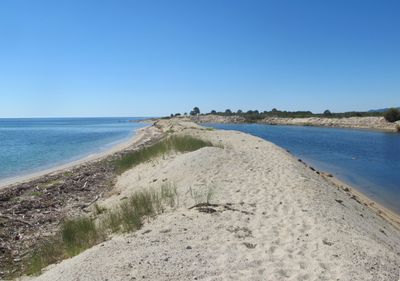
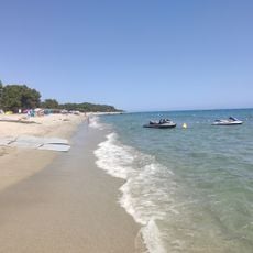
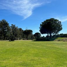
The Étang de Palo is a shallow coastal lagoon along eastern Corsica, spanning a large area with water typically reaching just 1 meter (3 feet) in depth. A sandbar separates it from the Tyrrhenian Sea, creating a partially enclosed environment where fresh and salt water mix.

The lagoon was born during the early post-ice age period when sand and sediment accumulated along the coast, slowly isolating a coastal basin from the sea. This gradual geological shift created the enclosed body of water we see today.

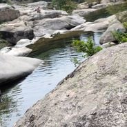
Local people have fished here for generations, catching eels and mullet from the shallow water. This practice remains central to how the community uses and values the lagoon today.

Visit during clear weather since the open landscape offers little shelter from sun and wind. Wear sturdy footwear to navigate the soft sand and wet ground safely.

The wetland attracts numerous bird species that stop here during migration and breeding seasons. This makes it an important destination for anyone interested in observing wild birds in their natural setting.

Location: Serra-di-Fiumorbo

Elevation above the sea: 0 m

Part of: étang de Palo

GPS coordinates: 41.94640,9.40639

Latest update: December 6, 2025 17:46

Remote locations in Corsica beyond coastal routes

This collection connects the mountainous interior of Corsica with remote coastal sections and historical traces of early settlement. Hiking trails pass through forests and over passes to places largely untouched by mass tourism. The route includes granite formations rising from the sea and megalithic sites several thousand years old. In the mountains lie lakes of glacial origin, surrounded by pine trees and steep rock faces. Along the coast stand Genoese towers, once used for defense and now serving as landmarks. Beaches of pale sand or pebbles are often accessible only on foot or by boat. The collection leads to places such as Filitosa, where carved stelae stand among olive trees, the Calanche cliffs near Piana, whose reddish rocks are oddly shaped, and the Aiguilles de Bavella, rock spires rising above pine forests. The Scandola nature reserve extends along a jagged coastline, accessible only from the water. Monte Cinto is the island's highest peak and offers views over valleys and bays. Isolated coves such as Saleccia or Plage du Lotu lie behind hills and maquis scrubland. The collection also includes abandoned villages such as Occi, waterfalls dropping into natural pools, and trails through the Fango valley, where the river flows between granite boulders.

Reviews

Visited this place? Tap the stars to rate it and share your experience / photos with the community! Try now! You can cancel it anytime.

« Étang de Palo - Coastal lagoon in Serra-di-Fiumorbo, France » is provided by Around Us (aroundus.com). Images and texts are derived from Wikimedia project under a Creative Commons license. You are allowed to copy, distribute, and modify copies of this page, under the conditions set by the license, as long as this note is clearly visible.

Discover hidden gems everywhere you go!

From secret cafés to breathtaking viewpoints, skip the crowded tourist spots and find places that match your style. Our app makes it easy with voice search, smart filtering, route optimization, and insider tips from travelers worldwide. Download now for the complete mobile experience.

Around Us App Screenshot

A unique approach to discovering new places

Le Figaro

All the places worth exploring

France Info

A tailor-made excursion in just a few clicks

20 Minutes