Plateau de Malzéville, Natural reserve plateau in Meurthe-et-Moselle, France
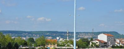
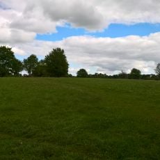
The Plateau de Malzéville is a limestone plateau near Nancy that covers a large area and is primarily forested with coniferous trees. The site is crossed by walking paths and geological circuits that allow visitors to explore different landscape types and geological features.
The plateau functioned as a military airfield until 1926 and played a role in early French aviation history. A significant ceremonial event took place there involving the presentation of an aviation flag during the First World War period.
The limestone plateau takes its name from a neighboring village and has become a destination for walkers who explore its varied terrain. The area holds particular value for those interested in observing the native plants and animals found in this region.
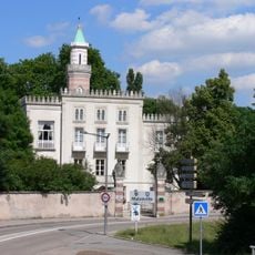
Access to the plateau is provided through parking areas located in Saint-Max and Malzéville that connect to the walking routes. The site is open year-round, though conditions vary depending on the season and weather patterns.
The elevated position and strong winds often keep the plateau snow-covered during winter while the surrounding plains remain clear. This creates a striking weather difference that allows visitors to experience two distinct climate zones within a short distance.
Location: Meurthe-et-Moselle
Elevation above the sea: 384 m
Made from material: limestone
Operator: Inventaire national du patrimoine naturel
Part of: Côtes de Moselle
GPS coordinates: 48.72759,6.19934
Latest update: December 12, 2025 17:43
Émetteur TDF de Malzéville
1 km
Grands-Moulins de Nancy
3 km
La Douëra
2.4 km
Cure d'air Trianon
2 km
Louis Marin viaduct
2.8 km
Malzéville bridge
2.7 km
Arboretum de l'Abiétinée
2.2 km
Église Saint-Vincent-de-Paul de Nancy
3 km
Église Saint-Georges d'Essey-lès-Nancy
2.6 km
Site archéologique d'Essey-Nancy
2.4 km
Pont Vayringe
2.6 km
Presbytère de Lay-Saint-Christophe
2.3 km
Église de l'Assomption d'Agincourt
2.9 km
Église Saint-Michel de Saint-Max
2.6 km
Église Saint-Livier de Saint-Max
3 km
Église Saint-Martin de Malzéville
2 km
Église Saint-Médard de Saint-Max
2.5 km
Église Saint-Martin de Dommartemont
2 km
Église Saint-Christophe de Lay-Saint-Christophe
2.3 km
Cinéma royal
3.2 km
Centre de ressources, d'expertise et de performance sportives de Nancy
3 km
Pont d'Essey
3.2 km
Chapelle Saint-Gauzelon de Malzéville
1.5 km
Église Saint-Pie-X d'Essey-lès-Nancy
3.2 km
Prieuré de Lay-Saint-Christophe
2.8 km
Chapelle musée Mathieu-de-Dombasle de Pixérécourt
1.5 km
Château de Bas
2.5 km
Pont levant de Malzéville
3 kmVisited this place? Tap the stars to rate it and share your experience / photos with the community! Try now! You can cancel it anytime.
Discover hidden gems everywhere you go!
From secret cafés to breathtaking viewpoints, skip the crowded tourist spots and find places that match your style. Our app makes it easy with voice search, smart filtering, route optimization, and insider tips from travelers worldwide. Download now for the complete mobile experience.
A unique approach to discovering new places❞
— Le Figaro
All the places worth exploring❞
— France Info
A tailor-made excursion in just a few clicks❞
— 20 Minutes