Enable Location

We need your location to show you interesting places around you

Discover nearby places

Find interesting locations and hidden gems around you

Precise directions

Get accurate directions and distances to places

Your location is never shared with other users. It's only used when you tap the location button.

Enceinte de Langres

Log in to your account

Start exploring — it's free

Trusted by 63,029 travelers worldwide

Continue with Google
Continue with Apple
or

We will send you a code to connect

By continuing, you accept our Terms and Conditions and our Privacy Policy

Check your inbox

We've sent a pincode in your inbox. Please enter the code below.

Enceinte de Langres
Discussion Reviews 2 Photos
3.8k Popularity

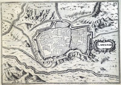
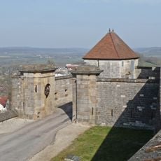
Enceinte de Langres, Medieval rampart in Langres, France

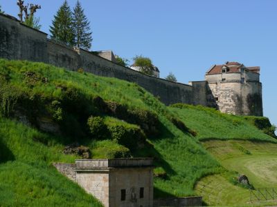
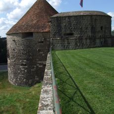
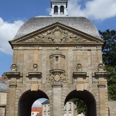
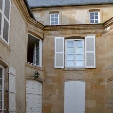
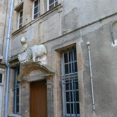
The enceinte of Langres is a fortification system that surrounds the town with walls extending several kilometers and includes defensive towers and bastions. The structure is built from pale limestone and displays different periods of reinforcement and modification.

The first walls were built in the 3rd century under Roman rule, but were changed and strengthened over many centuries. A major renovation occurred in the 17th century when King Louis XIV had the fortification modernized.

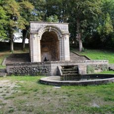
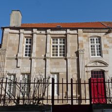
The walls remain a central part of how the town looks and feels today, shaped by the needs of different generations. Walking along them, you notice how construction styles shift and reveal the building methods that residents used across the ages.

Most of the wall can be explored on foot, with informational signs along the way explaining the various structures. Sturdy shoes are recommended, as the ground is uneven in places and some sections are steep.

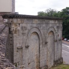
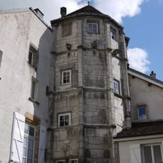
One of the towers, the Tower of Navarre, was converted into a powder magazine in the 19th century to store explosives. This change of purpose shows how military structures found new uses over time.

The community of curious travelers

AroundUs brings together thousands of curated places, local tips, and hidden gems, enriched daily by 60,000 contributors worldwide.

Start exploring
Location
GPS coordinates
47.85333,5.33389
Latest update
December 8, 2025 21:01
Reviews
Share your experience

No review yet

Discussions
Start a discussion...

No discussion yet

« Enceinte de Langres - Medieval rampart in Langres, France » is provided by Around Us (aroundus.com). Images and texts are derived from Wikimedia project under a Creative Commons license. You are allowed to copy, distribute, and modify copies of this page, under the conditions set by the license, as long as this note is clearly visible.

Discover hidden gems everywhere you go!

From secret cafés to breathtaking viewpoints, skip the crowded tourist spots and find places that match your style. Our app makes it easy with voice search, smart filtering, route optimization, and insider tips from travelers worldwide. Download now for the complete mobile experience.

Around Us App Screenshot

A unique approach to discovering new places

Le Figaro

All the places worth exploring

France Info

A tailor-made excursion in just a few clicks

20 Minutes

Around Us
Travel Guide & Maps
Download

Send to your phone

QR Code
1

Open the camera app on your mobile.

2

Point at the QR code with your camera. A notification will appear.

3

Tap the notification to open the link.