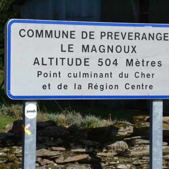
Le Magnoux, Mountain summit in Préveranges, France
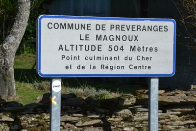
Le Magnoux is the highest point in the Centre-Val de Loire region, situated where three municipalities meet. From the summit, visitors can see across the surrounding landscape and look far into the distance on clear days.
Le Magnoux is a hamlet of Préveranges whose height, also called mont de Saint-Marien, gives its name to the highest point of the Cher department and of the Centre-Val de Loire region. The summit reaches 501 m and lies astride the Creuse department, in Nouvelle-Aquitaine. The hamlet's houses stand north of the departmental road that marks the departmental limit, while the water tower and orientation table at the top are south of it, in the commune of Saint-Marien. La Joyeuse has its source at Le Magnoux.
The summit is also called mont de Saint-Marien, after the Creuse commune where the orientation table stands. The hamlet of Le Magnoux lies entirely in the Cher, north of the road that marks the departmental border. The Joyeuse stream rises at Le Magnoux.
An orientation table at the summit helps visitors identify visible mountains and landmarks in the distance. It is best to visit in good weather to enjoy the clearest views.
The water tower and orientation table are technically located in the Creuse department, south of the main road, even though the summit itself belongs to Préveranges. This territorial oddity makes the site a place of geographical surprises.
The community of curious travelers
AroundUs brings together thousands of curated places, local tips, and hidden gems, enriched daily by 94,459 contributors worldwide.