Pic de Gleize, Mountain summit in Hautes-Alpes, France.
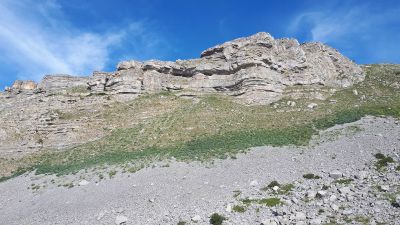
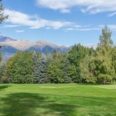
Pic de Gleize rises to 2,161 meters elevation, offering panoramic views over the Champsaur valley, Écrins massif, and Dévoluy mountains through its limestone formations.
The name Gleize derives from Occitan etymology referring to clay or argillaceous earth, reflecting the geological composition that has historically characterized this alpine region.
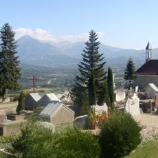
Local hiking traditions include both classic trail routes and technical south ridge climbing, representing the diverse outdoor recreation culture of the French Alps region.
The trailhead begins at Col de Gleize parking area at 1,696 meters elevation, requiring approximately 2.5 hours hiking time with 417 meters of positive elevation gain.
The summit offers a choice between two distinct ascent routes: the standard trail through alpine pastures or the more technical south ridge with light scrambling sections.
Location: Hautes-Alpes
Elevation above the sea: 2,161 m
GPS coordinates: 44.63383,6.04335
Latest update: July 25, 2025 23:03
Château de Charance
6.5 km
Chapelle Notre-Dame de Bois-Vert
3.8 km
National Alpine Botanical Conservatory
6.4 km
Monument de la Résistance du Champsaur-Valgaudemar
4.5 km
Chapelle Saint-Grégoire des Farreaux
3.1 km
Château de Charance
6.4 km
Église Saint-Louis-Roi-de-France de Forest-Saint-Julien
7 km
Golf de Gap-Bayard
4.5 km
Chapelle Sainte-Marie-l'Égyptienne à Saint-Laurent-du-Cros
4.6 km
Église Saint-Martin-de-Tours de Poligny
6.5 km
Notre Dame De Bois Vert
3.8 km
Chapelle de la Nativité-de-la-Vierge de Brutinel
4.5 km
Église de Saint-Julien-en-Champsaur
7.3 km
Église de Saint-Laurent-du-Cros
5.3 km
Église de Laye
3.5 km
Chapelle de Villard Trottier
7.3 km
Église de Rabou
5.8 km
Chapelle Saint-Antoine du Forest
7.1 km
Église paroissiale de Saint-Bonnet-en-Champsaur
5.9 km
Église de l'Assomption-de-Marie de La Fare-en-Champsaur
3.8 km
Chapelle Saint-Grégoire des Forestons
6.3 km
Chapelle Saint-Roch de l'Aullagnier
6.5 km
Chapelle des Allards
5.3 km
Chapelle de la Sainte-Famille des Alliberts
7 km
Chapelle Saint-Laurent du Chânet
7.1 km
Chapelle Saint-Roch de Serre-Richard
6.2 km
Temple de Saint-Laurent-du-Cros
5.7 km
Chapelle Saint-Étienne de Poligny
5.8 kmReviews
Visited this place? Tap the stars to rate it and share your experience / photos with the community! Try now! You can cancel it anytime.
Discover hidden gems everywhere you go!
From secret cafés to breathtaking viewpoints, skip the crowded tourist spots and find places that match your style. Our app makes it easy with voice search, smart filtering, route optimization, and insider tips from travelers worldwide. Download now for the complete mobile experience.
A unique approach to discovering new places❞
— Le Figaro
All the places worth exploring❞
— France Info
A tailor-made excursion in just a few clicks❞
— 20 Minutes