Forêt Domaniale de l'Estérel, National forest in Provence-Alpes-Côte d'Azur, France
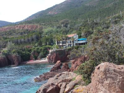
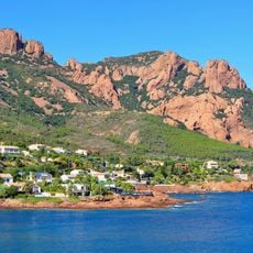
The Forêt Domaniale de l'Estérel is a woodland in Provence featuring red volcanic rocks and steep cliffs that drop toward the Mediterranean. The landscape combines rocky peaks, dense thickets, and dramatic coastal formations into one varied terrain.
The woodland came under state control in medieval times and was thereby protected from excessive cutting and overuse. This long period of management shaped how the forest exists today.
Local people have maintained a long connection to this woodland through traditional cork harvesting practices that shaped how the forest looks today. When you walk through, you can still see traces of these old practices in how the trees are managed.
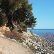
The forest has marked trails for hiking, cycling, and horseback riding with entry points near Saint-Raphaël. Arriving early helps you find parking and enjoy the trails without crowding, especially on weekends.
The red porphyry cliffs that drop straight into the sea are geologically rare and create dramatic boundaries between forest and water at many points. These rock formations appear nowhere else in France in this particular way.
The community of curious travelers
AroundUs brings together thousands of curated places, local tips, and hidden gems, enriched daily by 60,000 contributors worldwide.