Chest opened
+${chestReward.xp} XP
Explorer
NOUVEAU ×${chestReward.collectible.quantity}
tapez pour fermer
Chest locked

Open chests in the app

Around Us is built for your phone — chests unlock when you walk, explore and capture nearby places.

Enable Location

We need your location to show you interesting places around you

Discover nearby places

Find interesting locations and hidden gems around you

Precise directions

Get accurate directions and distances to places

Your location is never shared with other users. It's only used when you tap the location button.

Log in to your account

Start exploring — it's free

Trusted by 72,936 travelers worldwide

Continue with Google
Continue with Apple
or

We will send you a code to connect

By continuing, you accept our Terms and Conditions and our Privacy Policy

Check your inbox

We've sent a pincode in your inbox. Please enter the code below.

Montée Saint-Clair-Duport
Discussion Reviews Photo
2.1k Popularity

Montée Saint-Clair-Duport, Historic road in 5th arrondissement of Lyon, France

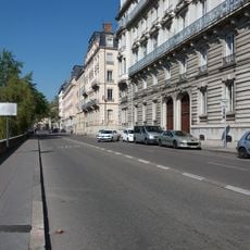
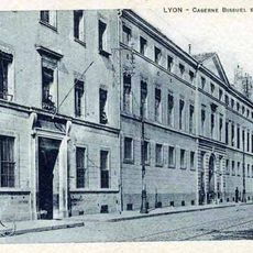
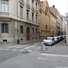
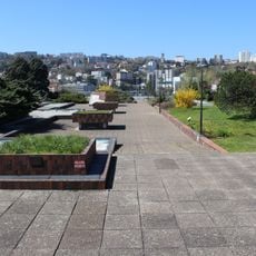
The montée Saint-Clair-Duport is a historic road in Lyon's 5th arrondissement that runs roughly 60 meters long and 10 meters wide. It connects Quai Fulchiron to Rue de la Quarantaine and forms part of the area's street network.

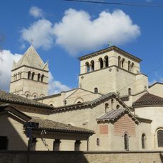
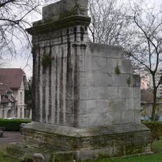
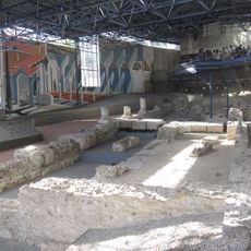
The street lost its primary function when the Fourvière tunnel was built in 1967 and fundamentally changed local traffic patterns. Archaeological digs in 1947 revealed that beneath the road lay remains of an early basilica and burials spanning many centuries.

The street carries the name of Clair-Dominique-Eugène Duport, an economist who led Lyon's civic hospitals and left his mark on local memory. This naming choice reflects how the city honored figures who contributed to public welfare.

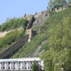
The street remains accessible on foot through the adjoining roads, though its original traffic function has been superseded. Visitors should be aware that the terrain in this area is steep and sturdy footwear is advisable.

Beneath this street lay a mass grave from the plague outbreak of 1628, evidence of the site's prolonged occupation. This finding documented human activity at the location from at least the 7th through 17th centuries.

The community of curious travelers

AroundUs brings together thousands of curated places, local tips, and hidden gems, enriched daily by 60,000 contributors worldwide.

Start exploring
Length
60 m
Width
10 m
Part of
thoroughfare network of Lyon
GPS coordinates
45.75222,4.82139
Latest update
December 13, 2025 17:00
Reviews
Share your experience

No review yet

Discussions
Start a discussion...

No discussion yet

« Montée Saint-Clair-Duport - Historic road in 5th arrondissement of Lyon, France » is provided by Around Us (aroundus.com). Images and texts are derived from Wikimedia project under a Creative Commons license. You are allowed to copy, distribute, and modify copies of this page, under the conditions set by the license, as long as this note is clearly visible.

Discover hidden gems everywhere you go!

From secret cafés to breathtaking viewpoints, skip the crowded tourist spots and find places that match your style. Our app makes it easy with voice search, smart filtering, route optimization, and insider tips from travelers worldwide. Download now for the complete mobile experience.

Around Us App Screenshot

A unique approach to discovering new places

Le Figaro

All the places worth exploring

France Info

A tailor-made excursion in just a few clicks

20 Minutes

Around Us
Travel Guide & Maps
Download

Send to your phone

QR Code
1

Open the camera app on your mobile.

2

Point at the QR code with your camera. A notification will appear.

3

Tap the notification to open the link.