Enable Location

We need your location to show you interesting places around you

Discover nearby places

Find interesting locations and hidden gems around you

Precise directions

Get accurate directions and distances to places

Your location is never shared with other users. It's only used when you tap the location button.

Fort Saint-Michel

Log in to your account

Start exploring — it's free

Trusted by 62,567 travelers worldwide

Continue with Google
Continue with Apple
or

We will send you a code to connect

By continuing, you accept our Terms and Conditions and our Privacy Policy

Check your inbox

We've sent a pincode in your inbox. Please enter the code below.

Fort Saint-Michel, fortification à Verdun (Meuse)

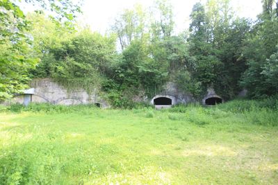
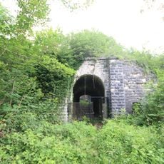
Fort Saint-Michel is a fortification built between 1875 and 1877 that sits on a hill just outside Verdun's center. The structure features a five-sided polygon design with thick stone walls, underground tunnels, and narrow gun ports typical of late 19th century military architecture.

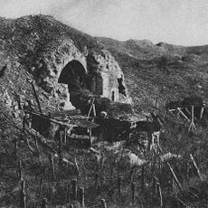
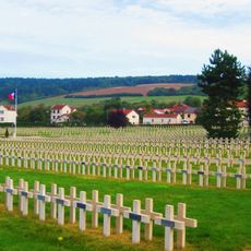
The fort was quickly built in 1874-1875 as part of a defensive line after France's defeat in the Franco-Prussian War of 1870 and growing fears of renewed attack. It formed part of a network of six main outposts designed to protect the right bank of the Meuse River and later held strategic importance during World War I.

The fort's name references the patron saint under whose protection the structure was built. It remains a symbol in Verdun's collective memory of defensive fortification and shapes how visitors understand the region's military heritage today.

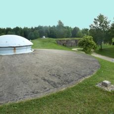
The site sits on a slope with good views of the surrounding area and is accessible by car with parking available nearby. Visit during mild weather to explore comfortably on foot, and wear sturdy shoes as the terrain is uneven and some areas may be unstable or unsafe.

The fort was renamed in 1887 by government decree after General Rouyer, a French military leader, but its original name was later restored, making this renaming an overlooked detail in its complex local story. This unusual name change shows how political decisions of the era shaped the fort's identity.

The community of curious travelers

AroundUs brings together thousands of curated places, local tips, and hidden gems, enriched daily by 60,000 contributors worldwide.

Start exploring
Location
Inception
1877
Part of
Forts of Verdun, Séré de Rivières system
GPS coordinates
49.17556,5.41472
Latest update
February 9, 2026 07:43
« Fort Saint-Michel - fortification à Verdun (Meuse) » is provided by Around Us (aroundus.com). Images and texts are derived from Wikimedia project under a Creative Commons license. You are allowed to copy, distribute, and modify copies of this page, under the conditions set by the license, as long as this note is clearly visible.

Discover hidden gems everywhere you go!

From secret cafés to breathtaking viewpoints, skip the crowded tourist spots and find places that match your style. Our app makes it easy with voice search, smart filtering, route optimization, and insider tips from travelers worldwide. Download now for the complete mobile experience.

Around Us App Screenshot

A unique approach to discovering new places

Le Figaro

All the places worth exploring

France Info

A tailor-made excursion in just a few clicks

20 Minutes

Around Us
Travel Guide & Maps
Download

Send to your phone

QR Code
1

Open the camera app on your mobile.

2

Point at the QR code with your camera. A notification will appear.

3

Tap the notification to open the link.