Chest opened
+${chestReward.xp} XP
Explorer
NOUVEAU ×${chestReward.collectible.quantity}
tapez pour fermer
Chest locked

Open chests in the app

Around Us is built for your phone — chests unlock when you walk, explore and capture nearby places.

Enable Location

We need your location to show you interesting places around you

Discover nearby places

Find interesting locations and hidden gems around you

Precise directions

Get accurate directions and distances to places

Your location is never shared with other users. It's only used when you tap the location button.

Col de la Loze

Log in to your account

Start exploring — it's free

Trusted by 72,886 travelers worldwide

Continue with Google
Continue with Apple
or

We will send you a code to connect

By continuing, you accept our Terms and Conditions and our Privacy Policy

Check your inbox

We've sent a pincode in your inbox. Please enter the code below.

Col de la Loze
Discussion Reviews 1 Photos
18.9k Popularity

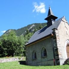
Col de la Loze, Mountain pass in Savoie, France

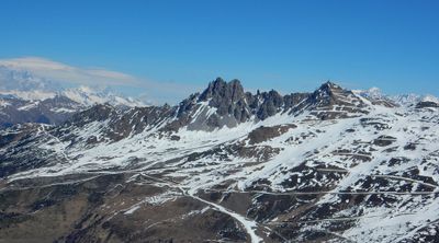
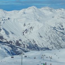
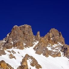
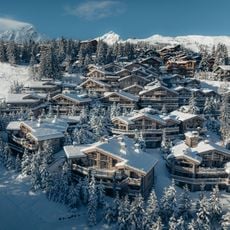
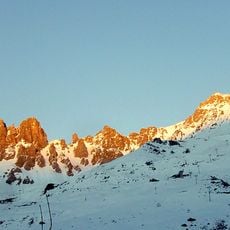
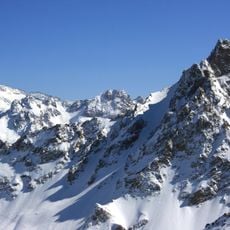
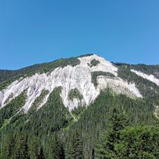
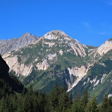
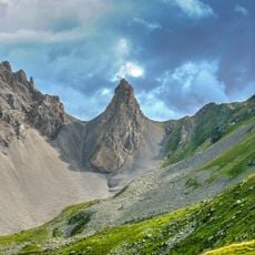
Col de la Loze is a mountain pass in the French Alps situated at 2,304 meters (7,560 ft), forming a direct connection between the Méribel and Courchevel ski resorts. The route traverses an open alpine valley with exposed rock faces and panoramic views in all directions.

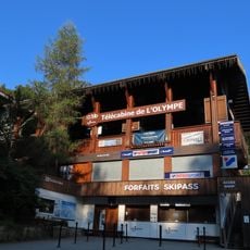
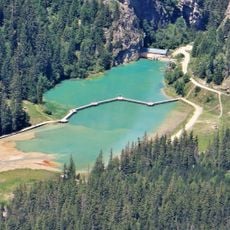
The pass received a paved road in 2019, making it accessible for vehicles and cyclists and connecting the two ski resorts for the first time as a direct route. This infrastructure opened up a previously separated region to new forms of transportation and recreation.

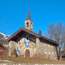
The name comes from Francoprovençal and refers to the slate stones common in this mountain region. Both locals and visitors use this route to experience the alpine landscape and connect the two major ski areas.

The climb from Moûtiers is about 26.5 kilometers long with sections reaching 20 percent grade, making it demanding for cyclists. Dedicated bicycle lanes separate riders from motor traffic on both sides of the pass.

The cycling infrastructure splits into two separate dedicated paths after the summit, extending about 7 kilometers toward Méribel and 6.5 kilometers toward Courchevel. These divided routes ensure riders remain separated from motor vehicles throughout their descent.

The community of curious travelers

AroundUs brings together thousands of curated places, local tips, and hidden gems, enriched daily by 60,000 contributors worldwide.

Start exploring
Location
Elevation above the sea
2,304 m
Address
Col de la Loze, 73550 Les Allues, France
GPS coordinates
45.40508,6.60160
Latest update
December 7, 2025 10:08
Reviews
Share your experience

No review yet

Discussions
Start a discussion...

No discussion yet

« Col de la Loze - Mountain pass in Savoie, France » is provided by Around Us (aroundus.com). Images and texts are derived from Wikimedia project under a Creative Commons license. You are allowed to copy, distribute, and modify copies of this page, under the conditions set by the license, as long as this note is clearly visible.

Discover hidden gems everywhere you go!

From secret cafés to breathtaking viewpoints, skip the crowded tourist spots and find places that match your style. Our app makes it easy with voice search, smart filtering, route optimization, and insider tips from travelers worldwide. Download now for the complete mobile experience.

Around Us App Screenshot

A unique approach to discovering new places

Le Figaro

All the places worth exploring

France Info

A tailor-made excursion in just a few clicks

20 Minutes

Around Us
Travel Guide & Maps
Download

Send to your phone

QR Code
1

Open the camera app on your mobile.

2

Point at the QR code with your camera. A notification will appear.

3

Tap the notification to open the link.