Surrounding wall of the national domain of Chambord

Log in to your account

AroundUs is a community-driven map of interesting places, built by curious explorers like you. It grows with every review, story, and photo you share.
Connect to save your favorite spots, contribute locations, and create personalized routes.
Continue with Google
Continue with Apple
Continue with X
Continue with Facebook
Continue with email
By continuing, you accept our Terms and Conditions and our Privacy Policy
Create an account

Surrounding wall of the national domain of Chambord

Add to collection
Map
Suggest a change
Share

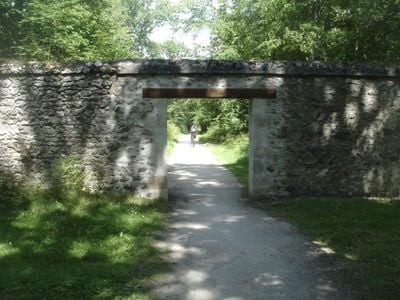
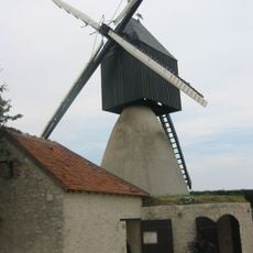
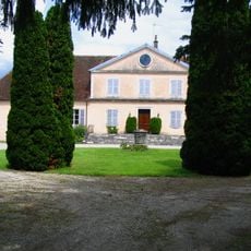
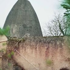
Surrounding wall of the national domain of Chambord, Stone wall of historic monument in Chambord, France.

The surrounding wall of the national domain of Chambord is a stone barrier that encloses a vast royal estate, running continuously with a uniform height of 2.5 meters (8 feet). It creates a distinct perimeter that separates the forest and wildlife habitat within from the lands beyond.

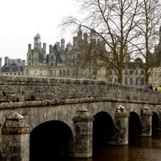
Construction of the boundary wall began in 1524 when Francis I decided to enclose the royal hunting grounds within a defined territory. This massive building project reflected the king's desire to reserve vast forest lands exclusively for his own use.

The wall defines the boundary between the royal estate and the surrounding land, making the division between private domain and public forest visible to anyone who walks here. This physical separation reflects how rulers once marked their territories.

You can enter the domain through several gates built into the wall, which provide access to walking and cycling paths around the property. Bring comfortable shoes, as the routes cover substantial distances through forest and open land.

The wall encloses a working forest ecosystem where wild animals thrive, protected from outside interference while remaining contained within the domain. Few visitors realize that the boundary serves as both a barrier and a haven for the wildlife inside.

Location: Chambord

Inception: 1524

Height: 2.5 m

Part of: Domaine national de Chambord

GPS coordinates: 47.62562,1.58939

Latest update: December 9, 2025 12:28

Photos
Reviews

Visited this place? Tap the stars to rate it and share your experience / photos with the community! Try now! You can cancel it anytime.

« Surrounding wall of the national domain of Chambord - Stone wall of historic monument in Chambord, France » is provided by Around Us (aroundus.com). Images and texts are derived from Wikimedia project under a Creative Commons license. You are allowed to copy, distribute, and modify copies of this page, under the conditions set by the license, as long as this note is clearly visible.

Discover hidden gems everywhere you go!

From secret cafés to breathtaking viewpoints, skip the crowded tourist spots and find places that match your style. Our app makes it easy with voice search, smart filtering, route optimization, and insider tips from travelers worldwide. Download now for the complete mobile experience.

Around Us App Screenshot

A unique approach to discovering new places

Le Figaro

All the places worth exploring

France Info

A tailor-made excursion in just a few clicks

20 Minutes