Enable Location

We need your location to show you interesting places around you

Discover nearby places

Find interesting locations and hidden gems around you

Precise directions

Get accurate directions and distances to places

Your location is never shared with other users. It's only used when you tap the location button.

Plan du Salève

Log in to your account

Start exploring — it's free

Trusted by 61,495 travelers worldwide

Continue with Google
Continue with Apple
or

We will send you a code to connect

By continuing, you accept our Terms and Conditions and our Privacy Policy

Check your inbox

We've sent a pincode in your inbox. Please enter the code below.

Plan du Salève

Plan du Salève, Mountain summit and viewpoint in Vovray-en-Bornes, France

Description

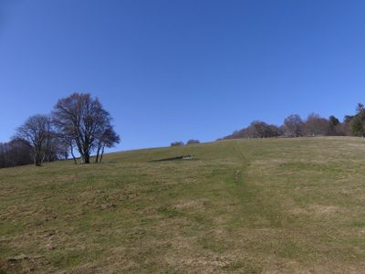
Plan du Salève is a mountain summit near Geneva that rises above the surrounding limestone plateau. From this high point, the terrain drops away to reveal views across the lake, the distant Jura ridges, and the peaks along the Swiss border.

History

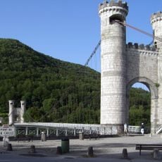
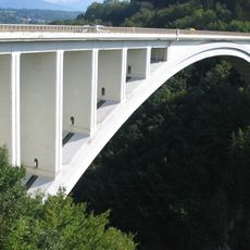
A cable car system connecting the lower villages to this summit was built during the mid-20th century to bring visitors up the steep mountainside. This infrastructure transformed the location from a remote hiking destination into an accessible tourist area.

Culture

Local mountain restaurants at Plan du Salève serve regional French dishes while visitors observe the panoramic views of Switzerland and France.

Practical

The cable car provides the quickest way to reach the summit and runs throughout the day with more frequent trips during busy periods. Hiking trails also lead to the top, though these take considerably longer and require sturdy footwear and basic mountain preparation.

Did you know?

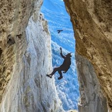
This location serves as a center for paragliding, with designated launch zones perched on the mountainside where pilots take off into the open air. On clear days you can watch paragliders drifting above the valley, their silhouettes crossing between the French and Swiss skies.

Location
Elevation above the sea
1,348 m
GPS coordinates
46.07737,6.12574
Latest update
December 15, 2025 13:23

AroundUs brings together thousands of curated places, local tips, and hidden gems, enriched daily by 60,000 contributors worldwide. Discover all places nearby (Vovray-en-Bornes).

« Plan du Salève - Mountain summit and viewpoint in Vovray-en-Bornes, France » is provided by Around Us (aroundus.com). Images and texts are derived from Wikimedia project under a Creative Commons license. You are allowed to copy, distribute, and modify copies of this page, under the conditions set by the license, as long as this note is clearly visible.

Discover hidden gems everywhere you go!

From secret cafés to breathtaking viewpoints, skip the crowded tourist spots and find places that match your style. Our app makes it easy with voice search, smart filtering, route optimization, and insider tips from travelers worldwide. Download now for the complete mobile experience.

Around Us App Screenshot

A unique approach to discovering new places

Le Figaro

All the places worth exploring

France Info

A tailor-made excursion in just a few clicks

20 Minutes

Around Us
Travel Guide & Maps
Download

Send to your phone

QR Code
1

Open the camera app on your mobile.

2

Point at the QR code with your camera. A notification will appear.

3

Tap the notification to open the link.