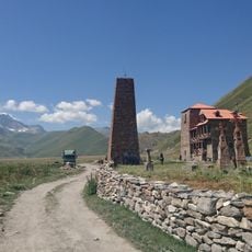
Zilgakhokhi, Mountain summit in Shida Kartli and Mtskheta-Mtianeti, Georgia
Zilgakhokhi is a summit on the main Caucasus watershed ridge, on the administrative border between Javakheti's Javakheti municipality (Shida Kartli) and Kazbegi municipality (Mtskheta-Mtianeti). It reaches 3,857 m and is built of Upper Jurassic–Valanginian marls, limestones, conglomerates, clay shales and sandstones. Its slopes are steep, with subnival and nival landscapes; the Terek rises on its north-eastern slope.
The first recorded ascent was made in 1852 by the Russian geodesist Iosif Khodzko, a lieutenant general of Polish origin. The peak lies on the watershed of the Caucasus range, between the sources of the Sbisa and the Cheliatistskali (Liakhvi basin), with the Terek rising on its north-eastern slope. The Roki Pass, a route between the upper Greater Liakhvi and the Ardon, lies just west of the summit.
The name comes from Ossetian "Zilgæ khokh", "the turning mountain", and Georgian "Zilgakhokhi". The summit stands on the watershed of the Caucasus range, on the border of South Ossetia and Georgia, between the sources of the Sbis and the Cheliatistskali in the Liakhvi basin. The Terek rises on its north-eastern slope.
Climbing this peak requires advanced mountaineering skills and proper technical equipment to navigate the steep terrain safely. The best window for climbing runs from July through September when weather conditions are most favorable.
From the summit you can see both the northern and southern slopes of the Caucasus range at the same time, offering views across territories in Georgia and Russia. This rare vantage point gives climbers a complete panorama of how the mountain range spans the region.
The community of curious travelers
AroundUs brings together thousands of curated places, local tips, and hidden gems, enriched daily by 93,195 contributors worldwide.