Lieksa, Municipality in North Karelia, Finland
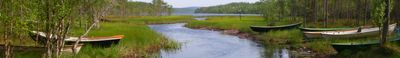
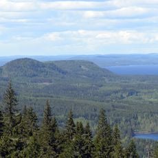
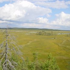
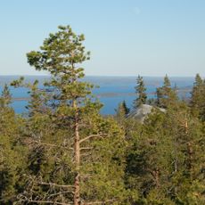
Lieksa is a town in North Karelia surrounded by extensive forests and numerous lakes that define its landscape. The waters and woodlands create a natural setting where settlement and wilderness coexist throughout the region.
The town took its current form in 1973 when a market town merged with a neighboring municipality to create a unified administrative area. This combination shaped the region as it exists today.
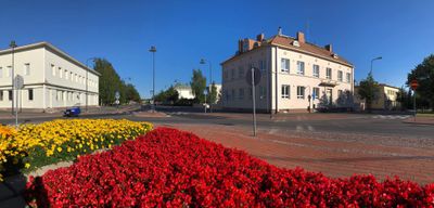
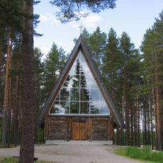
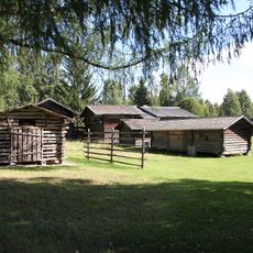
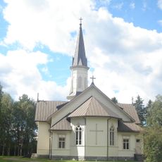
Finnish traditions shape the rhythm of daily life here, where residents speak their native language and maintain local customs that connect them to the region's heritage.
Activities on the water and in the forest are available year-round, though each season offers different experiences. Summer through early autumn provides the best conditions for exploring and getting around the region.
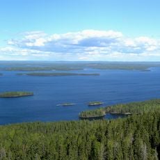
In winter months, the largest lake freezes solid enough to become a natural passageway connecting two distant districts across its ice. This rare occurrence allows people to drive directly across the frozen surface from one area to another.
Location: North Karelia
Reference: 422
Shares border with: Joensuu, Ilomantsi, Juuka, Kontiolahti, Kuhmo, Nurmes
Website: https://lieksa.fi/en/web/en
GPS coordinates: 63.31806,30.02500
Latest update: December 19, 2025 23:29
Koli
27.2 km
Koli National Park
29.8 km
Patvinsuo National Park
41.1 km
Paateri Church
18.6 km
Pielinen Museum
837 m
Viekijärvi Church
27.3 kmPikkukili
27 kmVornantie
29.7 kmRuokolaisten muistomerkki
39.2 km
Naarva Borderland Church
61.2 kmIson Mahosaaren jätinkirkko
9.7 kmAsesepän paja
61.4 kmUkko-Koli
26.5 km
Nurmijärvi parish house
23.2 kmPankakoski ironworks
5.9 kmAittokoski
43 kmKalmonniemi
22.2 kmHeinäjoen motti
30.1 kmБратская могила воинов, погибших в годы Великой Отечественной войны 1941-1945 гг. (Ребольское с. п.)
39.9 kmKukkokivi (bato sa Finlandia, Pohjois-Karjala)
14 kmPirunkivi (bato sa Finlandia, Pohjois-Karjala)
26.1 kmБратская могила 11 красноармейцев и председателя Лужнинского Cовета Л.В. Константинова, расстрелянных белофиннами (Лендеры)
58 kmMätäsvaaran kaivosyhdyskunta
26.2 km
Paha-Koli
27.4 kmМогила председателя исполкома Кимоваарского волостного Совета Ярвеляйнена, расстрелянного белогвардейцами (Кимоваара)
62.2 kmSärkkälammit 2
32 kmRajavyöhyke
46.5 kmHolmankivi
7.8 kmVisited this place? Tap the stars to rate it and share your experience / photos with the community! Try now! You can cancel it anytime.
Discover hidden gems everywhere you go!
From secret cafés to breathtaking viewpoints, skip the crowded tourist spots and find places that match your style. Our app makes it easy with voice search, smart filtering, route optimization, and insider tips from travelers worldwide. Download now for the complete mobile experience.
A unique approach to discovering new places❞
— Le Figaro
All the places worth exploring❞
— France Info
A tailor-made excursion in just a few clicks❞
— 20 Minutes