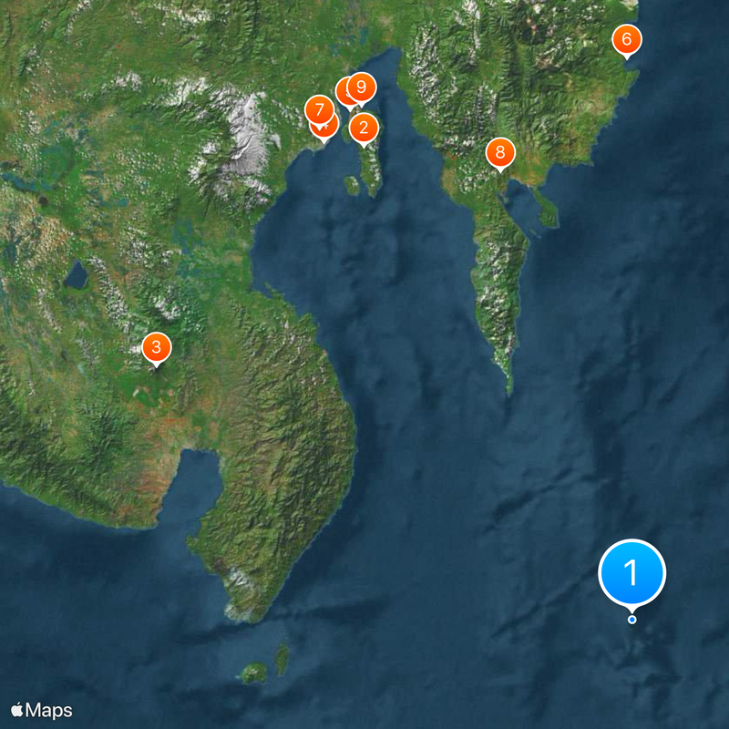
Miangas Island, Remote island in Talaud Islands Regency, Indonesia
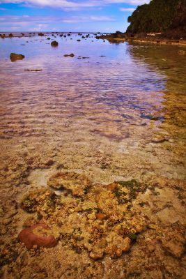
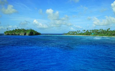
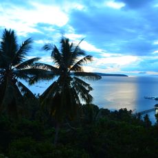
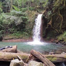
Miangas Island is an island in the Talaud Islands with white sandy beaches, coral reefs, and hilly terrain that reaches its highest point at Gunung Batu peak. The island supports a permanent population and is accessible by regular air service.
The island was first encountered by Spanish navigator Garcia Jofre de Loaisa in 1526, after which multiple European powers began competing for control. Subsequent territorial disputes between the Dutch and Americans shaped the island's colonial history.
The people here speak Indonesian and the local Talaud language, while some older residents also use Tagalog because of the island's closeness to the Philippines. This mix of languages reflects the community's long-standing ties to neighboring regions.
The island is reachable by regular flights from Manado airport, making it much easier to visit than relying on boat travel across the Celebes Sea. Travelers should expect limited tourist facilities and plan with flexibility for weather and flight conditions.
The island's name comes from its history as a place frequently attacked by raiders from Mindanao. This dangerous reputation stems from centuries of maritime conflict in the region.
Location: Talaud Islands
Elevation above the sea: 14 m
Part of: Talaud Islands
GPS coordinates: 5.55750,126.58333
Latest update: December 7, 2025 10:02
Samal
190.9 km
Mount Matutum
189.3 km
San Pedro Cathedral
199.4 km
Monfort Bat Sanctuary
204.3 km
Caraga Church
197.1 km
Davao River Bridge
204.2 km
Mati Protected Landscape
164.1 km
Secdea Beach Resort Reception Area
203.7 km
D' Bone Collector Museum
198.9 km
Mount Hamiguitan Range Wildlife Sanctuary
138.9 km
Museo Dabawenyo
199.4 km
Pacman Beach Resort Complex
169.9 km
Mount Hamiguitan
138.9 km
Tagbibinta Falls
201 km
Mount Parker
197.5 km
Davao City Hall historical marker
199.5 km
Gen. Paulino Santos historical marker
168.1 km
Andres Bonifacio historical marker
202.2 km
Davao Museum of History and Ethnography
201.1 km
Church of Caraga historical marker
197 km
Ohta Kyozaburo historical marker
208.8 km
Baywalk
160.2 km
Talisay Beach
193.2 km
Port Sta. Ana historical marker
199.4 km
Buhangin Memorial Park
204.1 km
Pujada Bay Protected Seascape
149 km
Ruins of Fort Marorong historical marker
128.9 km
Balnunto Falls
201.4 kmVisited this place? Tap the stars to rate it and share your experience / photos with the community! Try now! You can cancel it anytime.
Discover hidden gems everywhere you go!
From secret cafés to breathtaking viewpoints, skip the crowded tourist spots and find places that match your style. Our app makes it easy with voice search, smart filtering, route optimization, and insider tips from travelers worldwide. Download now for the complete mobile experience.
A unique approach to discovering new places❞
— Le Figaro
All the places worth exploring❞
— France Info
A tailor-made excursion in just a few clicks❞
— 20 Minutes