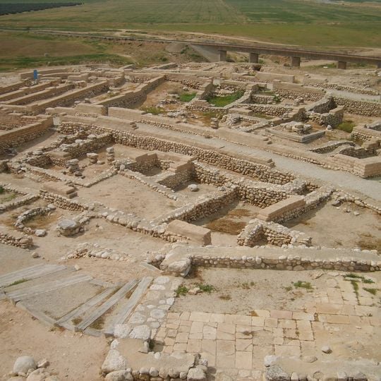
Tel Be'er Sheva, Archaeological site and national park in eastern Beersheba, Israel
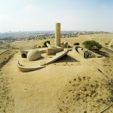
Tel Be'er Sheva is an excavated ancient settlement east of Beersheba with fortification walls, residential buildings, and storage structures from different historical periods. The site reveals the layout of a small city with structures that were used and modified over more than one thousand years.
The earliest remains date to the 4th millennium BCE; the tell was then abandoned for about two thousand years during the Bronze Age and resettled in the 11th century BCE. Its best-preserved layout is Stratum II, a planned Judean town of the late 8th century BCE destroyed by fire, possibly in Sennacherib's campaign of 701 BCE. It was rebuilt three times before final destruction in the late 7th century BCE, and later saw Persian, Hellenistic, Herodian, Roman, Byzantine and Crusader occupation. In 1917 Ottoman troops held the tell until New Zealand and Australian horsemen took it at 3 p.m. on 31 October.
The name Beersheba combines be'er, Hebrew for 'well', with sheva, 'oath' or 'seven'. The Bible names it as the place where Abraham and Abimelech made a covenant and where Abraham planted a tamarisk tree. A horned altar found at the site, its stones reused in a later wall, is the first such altar unearthed in Israel.
The national park has marked paths and informative signs in multiple languages to help you navigate the ruins. Bring plenty of water and sun protection, as the site sits in open desert terrain with little shade available.
The water system inside the walls was fed by a dam on Nahal Hevron: floodwater ran through a covered channel into a reservoir cut into chalk rock, reached from inside the city by stairs built in a shaft. It stayed in use until the late 1st century BCE. Outside the gate stood a well 69 m deep, its lower part cut into limestone.
The community of curious travelers
AroundUs brings together thousands of curated places, local tips, and hidden gems, enriched daily by 92,644 contributors worldwide.