Enable Location

We need your location to show you interesting places around you

Discover nearby places

Find interesting locations and hidden gems around you

Precise directions

Get accurate directions and distances to places

Your location is never shared with other users. It's only used when you tap the location button.

Ma'on, Har Hebron

Log in to your account

Start exploring — it's free

Trusted by 61,508 travelers worldwide

Continue with Google
Continue with Apple
or

We will send you a code to connect

By continuing, you accept our Terms and Conditions and our Privacy Policy

Check your inbox

We've sent a pincode in your inbox. Please enter the code below.

Ma'on, Har Hebron

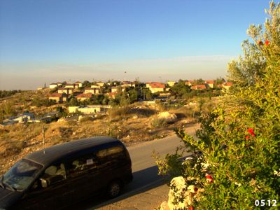
Ma'on, Har Hebron, Israeli moshav settlement in Judean Hills, Israel.

Description

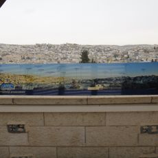
Ma'on is an Israeli moshav settlement in the Judean Hills situated at about 770 meters elevation, with residential neighborhoods and agricultural fields spread across the elevated terrain. It operates a shared dairy facility with about 400 cows run jointly with the neighboring settlement of Carmel.

History

The settlement was founded in 1981 by the Israeli military's Nahal program as a military outpost, with civilian settlers arriving in 1982. This model was typical of how many settlements in the region were established during that era.

Culture

The settlement operates on a cooperative model where residents share agricultural resources and make decisions together, while managing their own land individually. This shared approach shapes daily life and creates a tight-knit community centered on farming.

Practical

The terrain is hilly and relatively high in elevation, so visiting requires appropriate footwear and preparation for variable weather conditions. As with many private settlements, visitors should arrange ahead or familiarize themselves with local guidelines.

Did you know?

The location at Mediterranean altitude allows the cultivation of grapes, cherries, tomatoes, and olives, crops that are challenging to grow in most of the surrounding region. This combination of plant and livestock farming demonstrates how the elevated terrain shapes agricultural choices.

Location
Har Hevron Regional Council
Inception
1981
Founders
Nahal
Elevation above the sea
770 m
GPS coordinates
31.41333,35.16389
Latest update
December 10, 2025 16:21

AroundUs brings together thousands of curated places, local tips, and hidden gems, enriched daily by 60,000 contributors worldwide. Discover all places nearby (Har Hevron Regional Council).

« Ma'on, Har Hebron - Israeli moshav settlement in Judean Hills, Israel » is provided by Around Us (aroundus.com). Images and texts are derived from Wikimedia project under a Creative Commons license. You are allowed to copy, distribute, and modify copies of this page, under the conditions set by the license, as long as this note is clearly visible.

Discover hidden gems everywhere you go!

From secret cafés to breathtaking viewpoints, skip the crowded tourist spots and find places that match your style. Our app makes it easy with voice search, smart filtering, route optimization, and insider tips from travelers worldwide. Download now for the complete mobile experience.

Around Us App Screenshot

A unique approach to discovering new places

Le Figaro

All the places worth exploring

France Info

A tailor-made excursion in just a few clicks

20 Minutes

Around Us
Travel Guide & Maps
Download

Send to your phone

QR Code
1

Open the camera app on your mobile.

2

Point at the QR code with your camera. A notification will appear.

3

Tap the notification to open the link.