Aruppukkottai taluk, human settlement in India
Location: Virudhunagar district
GPS coordinates: 9.51000,78.10000
Latest update: October 18, 2025 19:57
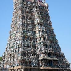
Meenakshi Temple
45.7 km
Thirumalai Nayakkar Mahal
45.2 km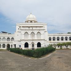
Gandhi Memorial Museum
46.9 km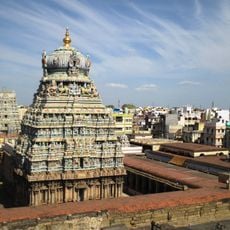
Koodal Azhagar Temple
46.8 km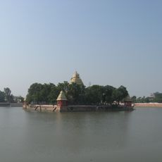
Vandiyur Mariamman Teppakulam
44.9 km
Samanar Hills
46.3 km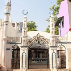
Kazimar Big Mosque
44.9 km
Thiruparankundram Dargah
42.6 km
Ninra Narayana Perumal temple
31.7 km
Pushpavaneswarar temple
39.2 km
Kasi Viswanathar temple, Sivakasi
34.1 km
Badrakali Amman temple, Sivakasi
33.7 km
Vandiyur Mariamman Temple
44.9 km
Thiru Aappanoor
45.6 km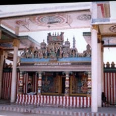
Shri Pathirakali Mariamman Temple
35.9 km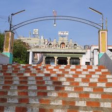
Karunellinathar temple
31.9 km
Sungam Mosque
44.9 km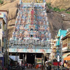
Thirupparamkunram Murugan Temple
41.3 km
Karisalkalampatti
31.8 km
St. Mary's Cathedral, Madurai
44.9 km
Temple Holy Car Shelter
45.7 km
Temple Holy Car Shelter
45.7 km
Vaishnavi Guhana
46 km
Pamayan organic form house
35.7 km
Madurai Maqbara
44.9 km
Statue, Work of art
41.6 km
Statue, Work of art
46.1 km
சுரபட்டி
34.4 kmReviews
Visited this place? Tap the stars to rate it and share your experience / photos with the community! Try now! You can cancel it anytime.
Discover hidden gems everywhere you go!
From secret cafés to breathtaking viewpoints, skip the crowded tourist spots and find places that match your style. Our app makes it easy with voice search, smart filtering, route optimization, and insider tips from travelers worldwide. Download now for the complete mobile experience.

A unique approach to discovering new places❞
— Le Figaro
All the places worth exploring❞
— France Info
A tailor-made excursion in just a few clicks❞
— 20 Minutes