Mettur Dam, Hydroelectric dam in Salem district, Tamil Nadu, India
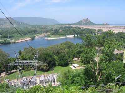
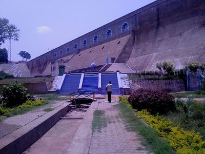
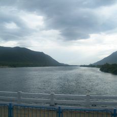
Mettur Dam is a gravity dam on the Kaveri River in Salem district, built with massive concrete blocks and featuring a row of large spillway gates along its crest. The structure forms the Stanley Reservoir, whose water level extends across several kilometers and is surrounded by forested hills rising on the horizon.
British colonial engineers completed construction in 1934 after the project required several years of planning and intensive building work with thousands of laborers. The completion transformed agriculture in the region by enabling reliable irrigation for areas previously dependent on monsoon rains.
The release of water from the reservoir defines the rhythm of planting cycles across much of Tamil Nadu, with farmers timing their sowing according to the opening of the gates. Local communities celebrate this annual release as a signal for the start of the growing season, often marked with traditional ceremonies of thanks.
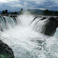
Visitors can walk along the top of the dam and view the river and reservoir from both sides, with early morning or late afternoon offering cooler temperatures. The site is most active during monsoon season when the spillway gates open and large volumes of water are released.
When the water level drops, the remains of submerged settlements become visible, including house foundations and religious structures abandoned before the valley was flooded. Local fishermen tell stories of the submerged church bell, which they claim can be heard from the bottom of the reservoir on quiet nights.
The community of curious travelers
AroundUs brings together thousands of curated places, local tips, and hidden gems, enriched daily by 60,000 contributors worldwide.