Enable Location

We need your location to show you interesting places around you

Discover nearby places

Find interesting locations and hidden gems around you

Precise directions

Get accurate directions and distances to places

Your location is never shared with other users. It's only used when you tap the location button.

Surtsey

Log in to your account

Start exploring — it's free

Trusted by 62,823 travelers worldwide

Continue with Google
Continue with Apple
or

We will send you a code to connect

By continuing, you accept our Terms and Conditions and our Privacy Policy

Check your inbox

We've sent a pincode in your inbox. Please enter the code below.

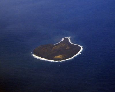
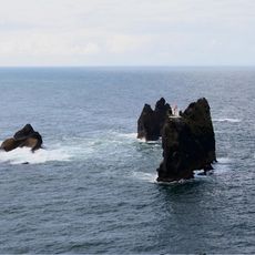
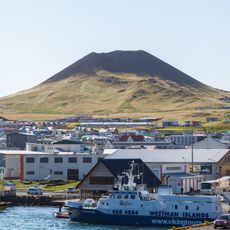
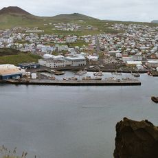
Surtsey, Volcanic island in Vestmannaeyjar, Iceland

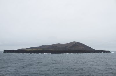
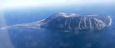
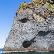
Surtsey rises roughly 500 feet (150 meters) above sea level and forms the southernmost point of the Vestmannaeyjar archipelago off Iceland's southern coast. The island covers about half a square mile (1.4 square kilometers) and consists of black volcanic rock constantly reshaped by wind and waves.

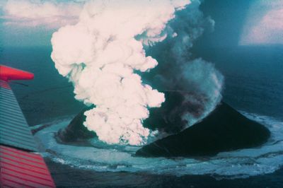
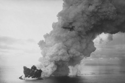
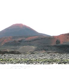
The island formed through underwater volcanic eruptions that began on November 14, 1963, and brought ash and lava to the ocean surface. The eruptions continued until June 5, 1967, creating new land that now sits under strict protection.

Scientists named the island after Surtr, a fire giant from Norse mythology who will set the world aflame during Ragnarök. This choice reflects how volcanic forces hold meaning in Icelandic imagination.

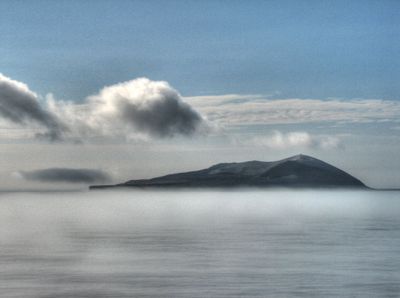
Access to the island is restricted to scientists and researchers to preserve natural conditions. Travelers can view the island only from a distance by boat or aircraft.

The island serves as an open-air laboratory where researchers document the natural arrival of plants, birds, and seals on fresh volcanic rock. Every new species is recorded, allowing scientists to track the sequence of life on bare stone.

The community of curious travelers

AroundUs brings together thousands of curated places, local tips, and hidden gems, enriched daily by 60,000 contributors worldwide.

Start exploring
Location
Inception
November 14, 1963
Elevation above the sea
155 m
Part of
Vestmannaeyjar
GPS coordinates
63.30403,-20.60471
Latest update
December 12, 2025 17:46
Satellite images showing incredible locations seen from the sky

Satellite imagery has transformed how we view remote locations on Earth, offering perspectives on places that are often invisible or difficult to reach from ground level. This collection presents natural formations, artificial structures and historical sites from an aerial vantage point. From...

« Surtsey - Volcanic island in Vestmannaeyjar, Iceland » is provided by Around Us (aroundus.com). Images and texts are derived from Wikimedia project under a Creative Commons license. You are allowed to copy, distribute, and modify copies of this page, under the conditions set by the license, as long as this note is clearly visible.

Discover hidden gems everywhere you go!

From secret cafés to breathtaking viewpoints, skip the crowded tourist spots and find places that match your style. Our app makes it easy with voice search, smart filtering, route optimization, and insider tips from travelers worldwide. Download now for the complete mobile experience.

Around Us App Screenshot

A unique approach to discovering new places

Le Figaro

All the places worth exploring

France Info

A tailor-made excursion in just a few clicks

20 Minutes

Around Us
Travel Guide & Maps
Download

Send to your phone

QR Code
1

Open the camera app on your mobile.

2

Point at the QR code with your camera. A notification will appear.

3

Tap the notification to open the link.