Lercara Friddi, Mining commune in Metropolitan City of Palermo, Italy
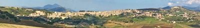
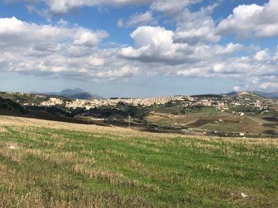
Lercara Friddi is a small commune situated on hillsides between river valleys in the Palermo province. The settlement developed as an administrative and residential center for the people who worked in the region's mining industry.
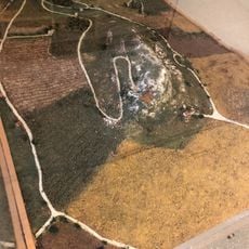
Spanish authorities founded Lercara Friddi in 1595 and granted the territory to an administrator to settle abandoned areas in Sicily. Sulfur deposits discovered around 1828 transformed the place into a major mining center for the province.
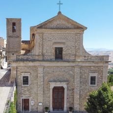
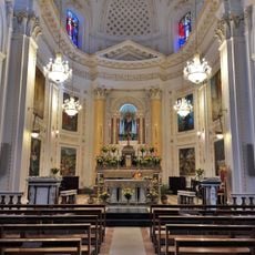
The Cathedral of Santa Maria della Neve stands at the heart of the town with its baroque facade and interior spaces where residents gather for religious occasions and community celebrations. It remains a center for social gatherings and local traditions throughout the year.
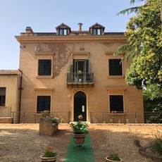
The town offers visitors access to a municipal library with a small museum that presents local history and mining heritage. The settlement sits on a hillside and is easy to explore on foot, allowing you to discover the main church and town center.
The town became the center of sulfur mining in the Palermo province and shaped the region's economy for over a century. This mining heritage left visible traces in the landscape and the buildings throughout the settlement.
Location: Metropolitan City of Palermo
Capital city: Lercara Friddi
Elevation above the sea: 670 m
Shares border with: Castronovo di Sicilia, Prizzi, Vicari, Roccapalumba
Website: http://comune.lercarafriddi.pa.it
GPS coordinates: 37.75000,13.60000
Latest update: December 17, 2025 08:12
Colle Madore
1.9 kmLago Fanaco
10.4 km
San Nicola di Bari
13.3 kmRiserva naturale orientata Monte Carcaci
7.9 km
Santuario Santa Maria delle Grazie
10.5 kmCastello della Margana
8.7 kmSerra del Leone e Monte Stagnataro
12.2 km
Museo della zolfara
263 mTorre San Pietro
9.9 kmRocche di Castronuovo, Pizzo Lupo, Gurghi di S. Andrea
9.6 kmCastello di Castronovo
8.1 kmVilla comunale Sant'Anna
158 mCalanchi, lembi boschivi e praterie di Riena
5.7 kmMonte Carcaci, Pizzo Colobria e ambienti umidi
9.1 kmCastello
13.2 kmLimen bizantino
6.9 kmMasseria fortificata di Colobria
8.9 kmFonte Rabato
8.1 kmFonte Regio
7.9 kmVia Archi
10.6 kmArea archeologica del Colle Madore
1.9 kmFonte Kassar
7.7 kmScenic viewpoint
8.2 kmPunto panoramico Kassar
6.9 kmScenic viewpoint
7.9 kmScenic viewpoint
13.2 kmScenic viewpoint
12.6 kmScenic viewpoint
10.8 kmVisited this place? Tap the stars to rate it and share your experience / photos with the community! Try now! You can cancel it anytime.
Discover hidden gems everywhere you go!
From secret cafés to breathtaking viewpoints, skip the crowded tourist spots and find places that match your style. Our app makes it easy with voice search, smart filtering, route optimization, and insider tips from travelers worldwide. Download now for the complete mobile experience.
A unique approach to discovering new places❞
— Le Figaro
All the places worth exploring❞
— France Info
A tailor-made excursion in just a few clicks❞
— 20 Minutes