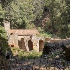
Poggio Ballone, Mountain summit in Grosseto, Italy
Poggio Ballone is a mountain summit in Grosseto province that rises to 631 meters above sea level. The ascent winds through cork oak and chestnut forests with varying grades and offers views across the surrounding landscape.
This mountain forms the southwestern extension of the Metalliferous Hills, a range shaped by ancient geological processes. Its position has long made it a natural landmark separating distinct Tuscan territories and river systems.
The massif lies within the municipalities of Castiglione della Pescaia, Gavorrano and Scarlino. Its slopes hold several hill towns: Scarlino sits on the north-western spur of Monte d'Alma, Gavorrano on the northern slopes of Monte Calvo, and Vetulonia with its archaeological area on Poggio di Vetulonia. Tirli stands near the main summit.
The summit is reached on foot or by mountain bike from Tirli, the nearest village, southwest of the 631-metre top. The massif spans Castiglione della Pescaia, Gavorrano and Scarlino, so approach routes start from several sides. The military radar station occupies the peak, so the final metres are not open to visitors.
The radar station on the 631-metre summit belongs to the Italian Air Force and controls air traffic over the entire Tyrrhenian Sea. The installation stands on the highest point of the massif, southwest of the village of Tirli, and is the reason the summit itself is not freely accessible.
The community of curious travelers
AroundUs brings together thousands of curated places, local tips, and hidden gems, enriched daily by 93,520 contributors worldwide.