Enable Location

We need your location to show you interesting places around you

Discover nearby places

Find interesting locations and hidden gems around you

Precise directions

Get accurate directions and distances to places

Your location is never shared with other users. It's only used when you tap the location button.

Lake Okutama

Log in to your account

Start exploring — it's free

Trusted by 63,115 travelers worldwide

Continue with Google
Continue with Apple
or

We will send you a code to connect

By continuing, you accept our Terms and Conditions and our Privacy Policy

Check your inbox

We've sent a pincode in your inbox. Please enter the code below.

Lake Okutama
Discussion Reviews 3 Photos
44k Popularity

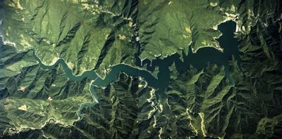
Lake Okutama, Mountain reservoir in Okutama, Japan.

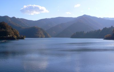
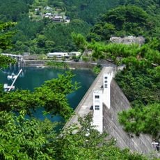
Lake Okutama is a reservoir in the forested mountains west of Tokyo, about 70 kilometers from the city center. The blue water sits at an elevation of roughly 530 meters, surrounded by steep hills, and stretches several kilometers through a narrow valley that shows different shades of green depending on the season.

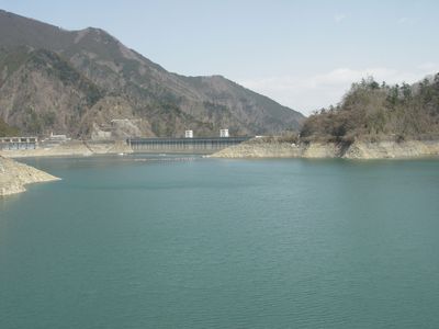
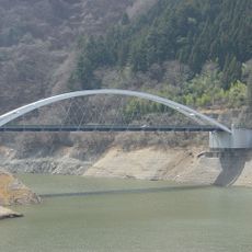
The Ogouchi Dam was completed in 1957 to supply fresh water to the growing capital, flooding several small villages in the process. This project marked postwar infrastructure expansion and transformed the Okutama region from a remote rural area into a strategic water reserve.

Locals sometimes call this reservoir Ogouchi Lake after the dam that created it, reflecting its practical role as a drinking water source for Tokyo. On sunny weekends, city dwellers come here to walk along the shoreline or hike in the surrounding forests, making the reservoir a retreat for people seeking relief from urban life.

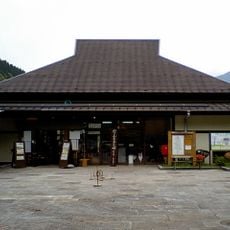
Getting there involves taking the JR Ome Line to Okutama Station, then catching a bus that takes around 18 minutes to reach Okutamako stop near the water. The best views come in spring and autumn when the weather is stable and the colors of the vegetation are particularly strong.

A floating pedestrian bridge made of resin, known as the Drum Can Bridge, sits directly on the water surface and moves gently with the waves. This unusual construction allows walkers to experience the water up close as they cross the reservoir.

The community of curious travelers

AroundUs brings together thousands of curated places, local tips, and hidden gems, enriched daily by 60,000 contributors worldwide.

Start exploring
Location
Elevation above the sea
526.5 m
Part of
Selected 100 Dam Lakes of Japan
GPS coordinates
35.77740,139.01140
Latest update
December 14, 2025 20:48
Reviews
Share your experience

No review yet

Discussions
Start a discussion...

No discussion yet

« Lake Okutama - Mountain reservoir in Okutama, Japan » is provided by Around Us (aroundus.com). Images and texts are derived from Wikimedia project under a Creative Commons license. You are allowed to copy, distribute, and modify copies of this page, under the conditions set by the license, as long as this note is clearly visible.

Discover hidden gems everywhere you go!

From secret cafés to breathtaking viewpoints, skip the crowded tourist spots and find places that match your style. Our app makes it easy with voice search, smart filtering, route optimization, and insider tips from travelers worldwide. Download now for the complete mobile experience.

Around Us App Screenshot

A unique approach to discovering new places

Le Figaro

All the places worth exploring

France Info

A tailor-made excursion in just a few clicks

20 Minutes

Around Us
Travel Guide & Maps
Download

Send to your phone

QR Code
1

Open the camera app on your mobile.

2

Point at the QR code with your camera. A notification will appear.

3

Tap the notification to open the link.