Chest opened
+${chestReward.xp} XP
Explorer
NOUVEAU ×${chestReward.collectible.quantity}
tapez pour fermer
Chest locked

Open chests in the app

Around Us is built for your phone — chests unlock when you walk, explore and capture nearby places.

Enable Location

We need your location to show you interesting places around you

Discover nearby places

Find interesting locations and hidden gems around you

Precise directions

Get accurate directions and distances to places

Your location is never shared with other users. It's only used when you tap the location button.

Log in to your account

Start exploring — it's free

Trusted by 72,892 travelers worldwide

Continue with Google
Continue with Apple
or

We will send you a code to connect

By continuing, you accept our Terms and Conditions and our Privacy Policy

Check your inbox

We've sent a pincode in your inbox. Please enter the code below.

Runit
Discussion Reviews Photo
71.3k Popularity

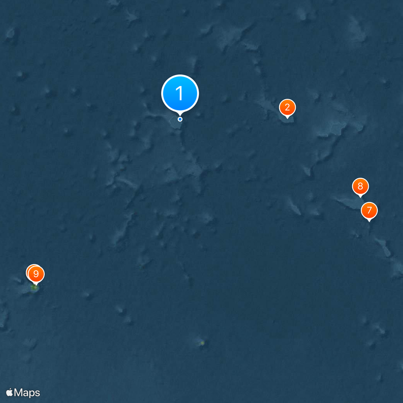
Runit, Nuclear waste containment site on Enewetak Atoll, Marshall Islands

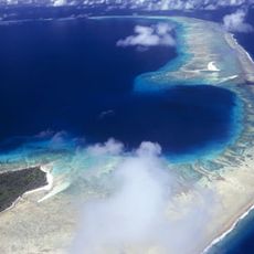
Runit is an island in Enewetak Atoll of the Marshall Islands in the Pacific Ocean, marked by a large concrete dome. The dome measures 350 feet (107 meters) across and rises about 25 feet (8 meters) above the ocean, covering contaminated material from the nuclear testing era.

The United States conducted dozens of nuclear tests in this atoll between 1946 and 1958, heavily contaminating several islands. Between 1977 and 1980, the American military gathered radioactive debris from six islands and sealed it beneath this concrete structure.

The traditional name of this island comes from the Marshallese language spoken by people who sailed these waters for centuries. Today the area remains off-limits to local residents, and the original inhabitants cannot return to their ancestral lands.

The island is closed to visitors, and scientists require special permits to conduct measurements on-site. Teams wear protective equipment and collect soil and groundwater samples to monitor the spread of radioactive materials.

The dome contains plutonium-239, which has a half-life of 24,000 years and remains dangerous throughout this period. Rising sea levels threaten the stability of the structure, as saltwater slowly attacks the concrete slabs and increases the risk of leaks.

The community of curious travelers

AroundUs brings together thousands of curated places, local tips, and hidden gems, enriched daily by 60,000 contributors worldwide.

Start exploring
Part of
Ralik Chain
GPS coordinates
11.54500,162.35300
Latest update
December 14, 2025 17:06
Reviews
Share your experience

No review yet

Discussions
Start a discussion...

No discussion yet

« Runit - Nuclear waste containment site on Enewetak Atoll, Marshall Islands » is provided by Around Us (aroundus.com). Images and texts are derived from Wikimedia project under a Creative Commons license. You are allowed to copy, distribute, and modify copies of this page, under the conditions set by the license, as long as this note is clearly visible.

Discover hidden gems everywhere you go!

From secret cafés to breathtaking viewpoints, skip the crowded tourist spots and find places that match your style. Our app makes it easy with voice search, smart filtering, route optimization, and insider tips from travelers worldwide. Download now for the complete mobile experience.

Around Us App Screenshot

A unique approach to discovering new places

Le Figaro

All the places worth exploring

France Info

A tailor-made excursion in just a few clicks

20 Minutes

Around Us
Travel Guide & Maps
Download

Send to your phone

QR Code
1

Open the camera app on your mobile.

2

Point at the QR code with your camera. A notification will appear.

3

Tap the notification to open the link.