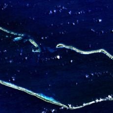
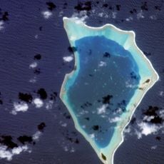
Bikini Atoll, Nuclear test site atoll in Marshall Islands
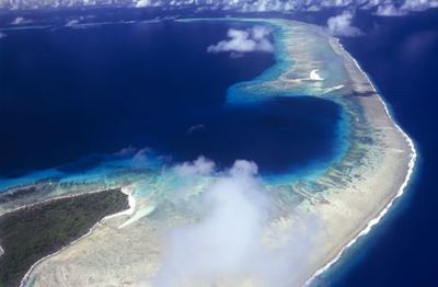
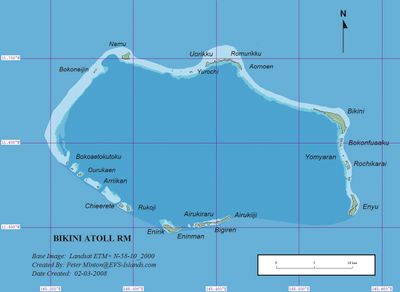
Bikini Atoll is a ring of coral islands enclosing a lagoon that covers 594 square kilometers (229 square miles) in the Pacific Ocean. The outer reef forms a barrier to the open sea, while the inner waters remain calm and contain several sunken ships from past experiments.
The United States military used this location for 23 nuclear weapon tests between 1946 and 1958, forcing the complete evacuation of the local population. The tests left lasting contamination that continues to prevent the displaced community from returning home.
The original inhabitants were relocated to other islands and continue to preserve their memories and connection to this place through oral tradition and community gatherings. For them, the atoll represents a homeland they cannot return to, a loss that shapes their identity and relationship with the broader Pacific region.
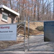
Entry requires special permits and organized tours because of radiation concerns and the need to protect historical remains. Visitors must arrange authorization well in advance and can only explore designated areas of the lagoon under strict supervision.
The lagoon floor holds multiple warships that were deliberately sunk during testing, including aircraft carriers and battleships that now form artificial reefs. These wrecks attract divers interested in exploring the rare combination of military history and underwater ecosystems.
Location: Marshall Islands
Location: Bikini Atoll
Elevation above the sea: 25 m
Part of: Ralik Chain
Address: Bikini Atoll, Marshall Islands
GPS coordinates: 11.60000,165.40000
Latest update: December 14, 2025 23:24
This collection brings together underground military sites, strategic bunkers, and highly secured installations across the world. Many of these places were built during the Cold War, when nuclear threats pushed governments to create protected command centers deep under mountains or in remote areas....
Majuro Atoll
819.2 km
Bikar Atoll
520.3 km
Kosrae State Museum
746.4 km
Debrum House
470.9 km
Cathedral of the Assumption, Majuro
825.6 km
Mount Finkol
748.6 km
Menke Ruins
749.8 km
Kwajalein Island Battlefield
410.3 km
Utwe
781.6 km
Likiep Village Historic District
452.7 km
Utwe-Walung Marine Park Offices
752.6 km
Roi-Namur Battlefield
334.4 km
Kwajalein Officer's Course
410.2 km
Emon Beach
408.4 km
Baet-Ul-Ahad Mosque
824.9 km
Guide for Waterfall & Mountain Trek
749.6 km
Abandoned house
804.2 km
Imperial Japanese Naval Base
782.5 km
Turtle Beach
408.7 km
Lopévi (Gipfel)
497.2 km
Laura Beach
791.9 km
Camp Hamilton Beach
409.6 km
Coral Sands Beach
409.3 km
Glass Beach
409.5 km
Bogon
347.5 km
Scenic viewpoint
744.5 km
Lelu Ruins Historic Park
745.1 km
Debrum House
470.9 kmVisited this place? Tap the stars to rate it and share your experience / photos with the community! Try now! You can cancel it anytime.
Discover hidden gems everywhere you go!
From secret cafés to breathtaking viewpoints, skip the crowded tourist spots and find places that match your style. Our app makes it easy with voice search, smart filtering, route optimization, and insider tips from travelers worldwide. Download now for the complete mobile experience.
A unique approach to discovering new places❞
— Le Figaro
All the places worth exploring❞
— France Info
A tailor-made excursion in just a few clicks❞
— 20 Minutes