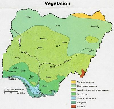
Niger Delta mangroves, Mangrove ecoregion in Niger Delta, Nigeria
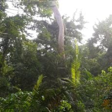
The Niger Delta mangroves form one of Africa's largest mangrove zones along the southern coast of Nigeria, where saltwater and freshwater meet and trees grow directly out of the water on exposed root systems. The area is made up of a dense web of tidal channels, small islands, and forest corridors that run along the Gulf of Guinea coastline.
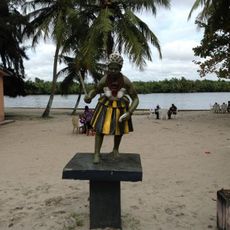
Coastal communities here have depended on the forests and waterways for food and resources for centuries, long before the area attracted outside attention. In the 1800s, European trading posts began to appear along the coast, marking the start of commercial interest that over time put pressure on the region's resources.
For the villages along the waterways, the mangroves are not just a backdrop but the place where daily work happens: fishing, gathering wood, and moving goods by dugout canoe. Local knowledge of the channels and tides is passed down through generations and shapes how communities think about the water around them.
There are no walking trails into the forest, so a boat is the only way to move through the area, and hiring a local guide with knowledge of the waterways is strongly advised. The dry season generally makes navigation easier and reduces insect activity, though water levels and conditions can shift quickly throughout the year.
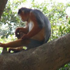
Some of the animal species living in these forests are found nowhere else on the continent, including rare primates and fish adapted to brackish water. The isolation created by the tangle of channels over thousands of years has allowed certain animals to evolve in ways that make them hard to find anywhere else.
The community of curious travelers
AroundUs brings together thousands of curated places, local tips, and hidden gems, enriched daily by 60,000 contributors worldwide.