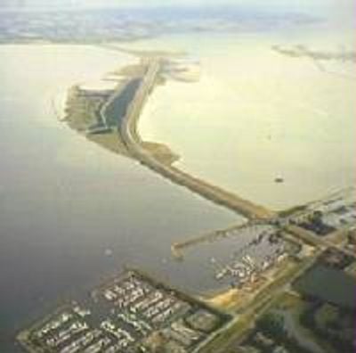
Grevelingendam, Compartmentation dam between Schouwen-Duiveland and Goeree-Overflakkee islands, Netherlands
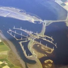
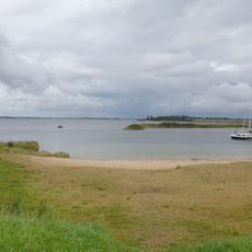
The Grevelingendam is a compartmentation dam extending 6 kilometers across water between two islands in southern Netherlands. It contains navigation locks and control structures that manage water flow while supporting the road that connects Schouwen-Duiveland to Goeree-Overflakkee.
Construction began in 1958 and finished in 1965 following the devastating 1953 North Sea flood that impacted the region. The project was part of the Delta Works, a major effort to prevent future flooding in low-lying Dutch areas.
The lock system reflects how Dutch engineers linked water management with transportation needs. Walking across the dam, you notice how it serves both as a barrier and a bridge connecting two communities.
The N59 motorway runs along the entire dam, making it the main vehicle connection between the islands. You can cross by car, bus, or bicycle with good views across the water on both sides.
Engineers used a cable car system to gradually close the northern channel during construction, managing the challenging tidal conditions. This innovative approach allowed the dam to be built safely despite the constantly shifting water levels.
Location: Schouwen-Duiveland
Location: Goeree-Overflakkee
Part of: Delta Works
GPS coordinates: 51.67778,4.11167
Latest update: December 10, 2025 20:10
Krammer
6.5 km
Grevelingen lock
1.7 km
Sint-Jodocuskerk
6.2 km
D'Oranjeboom
5.8 km
De Korenbloem
6.6 km
De Dankbaarheid
4.2 km
Watersnoodmonument Nieuwe-Tonge
5.7 km
Oosterlandse Molen
6.2 km
Hervormde Kerk
7.1 km
OLV Hemelvaart
7 km
Nederlands Hervormde Kerk, Nieuwe-Tonge
5.4 km
Oudelandsedijk 11, Oude-Tonge
6.6 km
Nederlands Hervormde Kerk
7.1 km
Hervormde Kerk
3.9 km
Boerderij 'Hooge werf'
6.9 km
Hoeve Nooitgedacht
2.4 km
Martelaren van Gorcumkapel
6.5 km
Rijksweg 16, Oosterland
6.1 km
Sluis Battenoord. Stichtingssteen met opschrift en jaartal
3.4 km
Bruinisse Werkhaven Badstrand
1.9 km
Sint Joostdijk 29, Oosterland
6.1 km
Oudestraat 27, Bruinisse
1.9 km
Hoeve "Torenstee" (voorheen "Bouw- en Veelust")
6.7 km
Indië-monument
5.8 km
Schuur
6.9 km
Groot, vrijstaand woonhuis, voormalige Nederlands Hervormde pastorie, met neo-barokke details
5.4 km
Visbank. Vier hardstenen zuilen met een houten tentdak
4 km
Kerktoren met zadeldak en aan de toren verbonden westgevel
6.3 kmVisited this place? Tap the stars to rate it and share your experience / photos with the community! Try now! You can cancel it anytime.
Discover hidden gems everywhere you go!
From secret cafés to breathtaking viewpoints, skip the crowded tourist spots and find places that match your style. Our app makes it easy with voice search, smart filtering, route optimization, and insider tips from travelers worldwide. Download now for the complete mobile experience.
A unique approach to discovering new places❞
— Le Figaro
All the places worth exploring❞
— France Info
A tailor-made excursion in just a few clicks❞
— 20 Minutes