Amstel, River and canal system in Amsterdam and North Holland, Netherlands
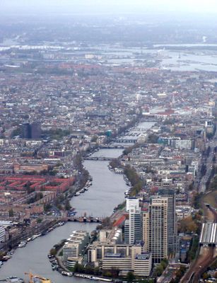
The Amstel is a river that winds through Amsterdam and branches into numerous canals forming a dense network of waterways. The system includes different canal layers with varying widths and depths, connecting different city districts and shaping Amsterdam's overall structure.
The river and its canal system developed in the 17th century as the city expanded rapidly and trade grew during the Dutch Golden Age. The waterways were systematically engineered and enlarged to handle goods movement and to supply new neighborhoods with water access.
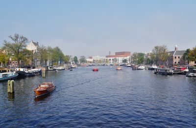
The canals shape everyday life in Amsterdam, where houseboats, small bridges, and waterside cafés create a living scene. Residents and visitors use the waterways for strolling, cycling, and lingering at the edges, making the water central to how the city feels and functions.
The waterways are best explored on foot or by bicycle, as many paths and cycling routes run along the canal edges. Boat tours are also available, though they offer a different view of the buildings and infrastructure than walking.
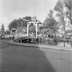
Hidden beneath bridges and along the canal edges are small courtyards and gardens rarely visible from the water. These quiet pockets show how city life and water intertwine in unexpected ways throughout Amsterdam.
Location: North Holland
GPS coordinates: 52.28750,4.88750
Latest update: December 14, 2025 21:17
Sint Urbanuskerk
1.3 km
Amstelkerk
1.4 km
Kerkbrug
1.3 km
Watertoren (Ouderkerk aan de Amstel)
773 m
De Oude Prins
1.4 km
Achterdijk 2, Ouderkerk aan de Amstel
1.3 km
Pastorie Sint Urbanuskerk, Ouderkerk aan de Amstel
1.3 km
Poortgebouw buskruitmolen (Ouderkerk)
754 m
't Jagerhuis
1.2 km
Rondehoep West 41, Ouderkerk aan de Amstel
286 m
Rondehoep West 40, Ouderkerk aan de Amstel
134 m
Kerkstraat 9, Ouderkerk aan de Amstel
1.4 km
Amsteldijk Zuid 91, Amstelveen
1.2 km
Amstelzijde 34, Amstelveen
1.3 km
Amstelzijde 28, Amstelveen
1.3 km
Amsteldijk Zuid 23-28
1 km
Amsteldijk Zuid 29-34
1 km
Gezellenhuis
1.3 km
Kerkstraat 1, Ouderkerk aan de Amstel
1.3 km
Kerkstraat 4, Ouderkerk aan de Amstel
1.4 km
Winkel-woonhuis, pand met afgeknotte houten lijstgevel
1.3 km
Pand met lijstgevel
1.4 km
Amstelzijde 30, Ouderkerk aan de Amstel
1.3 km
Transformatorhuisje
660 m
Amsteldijk Zuid 68, Amstelveen
566 m
Woonblok van drie diaconiewoningen onder een kap
1.4 km
Buskruit-molen nr. 3 / De Oude Molen
753 m
Amsteldijk Zuid 35-40
995 mVisited this place? Tap the stars to rate it and share your experience / photos with the community! Try now! You can cancel it anytime.
Discover hidden gems everywhere you go!
From secret cafés to breathtaking viewpoints, skip the crowded tourist spots and find places that match your style. Our app makes it easy with voice search, smart filtering, route optimization, and insider tips from travelers worldwide. Download now for the complete mobile experience.
A unique approach to discovering new places❞
— Le Figaro
All the places worth exploring❞
— France Info
A tailor-made excursion in just a few clicks❞
— 20 Minutes