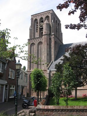
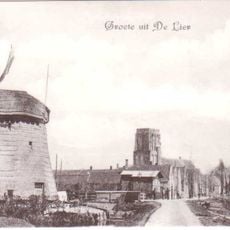
Nederlands Hervormde Kerk, De Lier, Late Gothic religious monument in De Lier, Netherlands.
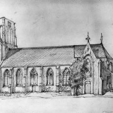
The Nederlands Hervormde Kerk is a Late Gothic church building in De Lier with a three-nave structure and stone columns supporting the interior. Wooden barrel vaults cover the space, with flanking chapels positioned on both sides of the choir area.
Construction started in the mid-15th century as the community needed a larger place to worship. After a fire destroyed parts of it in 1572, major repairs were completed in 1658 to strengthen the building.
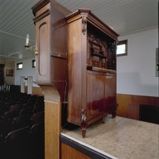
The interior displays 17th-century furnishings including a decorated pulpit with arched panels and historical grave stones throughout the church. These elements reflect the lives of those who worshipped here over the centuries.
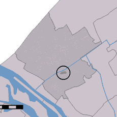
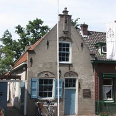
The building is located at Hoofdstraat 51 in De Lier and holds the status of a protected national monument. Visitors should plan visits during regular opening hours, as access may be limited due to its protected status.
The church tower leans noticeably to one side, requiring visitors to descend before they can begin climbing upward. This unusual feature makes the ascent a memorable experience for those who attempt it.
Location: Westland
Address: Hoofdstraat bij 53
GPS coordinates: 51.97444,4.24806
Latest update: December 14, 2025 13:07
Wollebrand
2 km
Westerlee
1.9 km
Oranjesluis, 's-Gravenzande
3.1 km
Het Kraaiennest
2.1 km
Groeneveldse Molen
3.2 km
Nieuwe Tuinen
2 km
Oostbuurt
1.9 km
De Timmerwerf
95 m
Proefstation van het Zuid-Hollands Glasdistrict
3.2 km
Burgemeester Elsenweg 45, Naaldwijk
2.1 km
Oude Liermolen
1.6 km
Zeven Gaten
2.1 km
Diepenburch
1.7 km
Hoefpoldermolen
193 m
Nederlands Hervormde Kerk
48 m
Kassen
3.1 km
Secretaireorgel (Maasdijk)
2.6 km
Gepleisterde boerderij uit de 17e of 18e eeuw met fraai bouwlichaam. Rieten schilddak en vensters met negenruitsschuiframen.
2.6 km
Westgaag 28, Maasland
3.1 km
Noord-Lierweg 4, De Lier
2.7 km
Kruisweg 23, Naaldwijk
2.9 km
Woudtzicht 1, De Lier
2.7 km
Herdenkingsmonument
173 m
Pand met trapgevel, versierd met geblokte ontlastingsbogen, natuurstenen waterlijsten en sierankers
85 m
Westgaag 74, Maasland
3.1 km
Hoofdstraat 63, De Lier
96 m
Kralingerpolder
3.2 km
Westgaag 100, Maasland
3.2 kmVisited this place? Tap the stars to rate it and share your experience / photos with the community! Try now! You can cancel it anytime.
Discover hidden gems everywhere you go!
From secret cafés to breathtaking viewpoints, skip the crowded tourist spots and find places that match your style. Our app makes it easy with voice search, smart filtering, route optimization, and insider tips from travelers worldwide. Download now for the complete mobile experience.
A unique approach to discovering new places❞
— Le Figaro
All the places worth exploring❞
— France Info
A tailor-made excursion in just a few clicks❞
— 20 Minutes